Monday, February 6th, 2017
After Rwanda made waves in early 2016 for allegedly being the first country to approve drone delivery, people payed attention. The country, with its rolling hills and one of the fastest-growing economies in Central Africa, now has established regulations regarding drones and has become a vanguard of sorts for the region. “My impression is that
Wednesday, February 1st, 2017
More accurate, immediate and economical information on severe weather phenomena such as hurricanes soon could be available thanks to the Weather Hazard Alert and Awareness Technology Radiation Radiosonde (WHAATRR) Glider. According to project manager Scott Wiley, the vehicle could potentially save the National Weather Service up to $15 million a year compared to current methods.
Tuesday, January 24th, 2017
Hydrologists at the Colorado Basin River Forecast Center are providing streamflow forecasts for watersheds within the Colorado River Basin, which includes some of the most parched land in the United States. “The forecasts we get from the center provide crucial information for managing our water resources and reservoir facilities,” said Dave Kanzer, a deputy chief
Tuesday, January 17th, 2017
The SWAP camera onboard the European Space Agency (ESA) Proba-2 satellite takes advantage of extreme ultraviolet wavelengths to capture the hot turbulent atmosphere of the Sun’s solar corona. To illustrate what SWAP does and what it can teach, ESA and the Royal Observatory of Belgium collected and published 366 solar images—one for each day of
Tuesday, January 10th, 2017
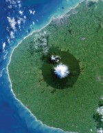
As part of the UK Space Agency’s recently launched International Partnership Programme (IPP) and its related Forests 2020 project, the agency awarded a contract worth more than £14 million to sustainability software and data company Ecometrica. The Forests 2020 project is expected to help countries improve management and protection across 300 million hectares of
Thursday, January 5th, 2017
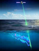
A new study using a NASA satellite instrument orbiting Earth found that small, environmental changes in polar food webs significantly influence the boom-and-bust cycles of phytoplankton. These findings, recently published in Nature Geoscience, will supply important data for ecosystem management, commercial fisheries and understanding of the interactions among Earth’s climate and key ocean ecosystems. “It’s
Tuesday, December 20th, 2016
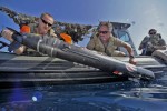
The Chinese seizure of a U.S. underwater drone in waters near The Philippines is raising international concern as well as highlighting the growing strategic and tactical significance of unmanned underwater vehicles (UUVs). According to a statement from Pentagon spokesman Peter Cook, “Using appropriate government-to-government channels, the Department of Defense has called upon China to immediately

Tuesday, December 13th, 2016
The central United States has undergone a dramatic increase in seismicity during the last six years. From 1973-2008, there was an average of 24 earthquakes of magnitude 3 and larger per year. From 2009-2014, the rate steadily increased, averaging 193 per year and peaking in 2014 with 688 earthquakes. So far in 2015, there have

Tuesday, December 6th, 2016
Every northern fall and winter, cooling ocean and air temperatures cause the floating cap of Arctic sea ice to grow from its annual minimum extent toward a maximum between February and April. So far in 2016, however, the Arctic Ocean and neighboring seas have been slow to freeze, setting both daily and monthly record lows.
Tuesday, November 29th, 2016
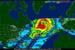
On Sept. 21, 2014, NASA scientists and engineers launched RapidScat toward the orbiting International Space Station, 250 miles above Earth’s surface, with a few objectives in mind: improve weather forecasting on Earth, provide cross-calibration for all international satellites that monitor ocean winds, and improve estimates of how ocean winds change throughout the day. Following the