Tuesday, July 23rd, 2024
Days on Earth are growing slightly longer, and that change is accelerating. The reason is connected to the same mechanisms that also have caused the planet’s axis to meander by about 30 feet (10 meters) in the past 120 years. The findings come from two recent NASA-funded studies focused on how the climate-related redistribution of

Monday, July 8th, 2024
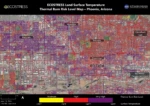
Researchers at NASA’s Jet Propulsion Laboratory in Southern California mapped scorching pavement in Phoenix where contact with skin—from a fall, for example—can cause serious burns. The image shows land-surface temperatures across a grid of roads and adjacent sidewalks, revealing how urban spaces can turn hazardous during hot weather. Data for this visualization of the Phoenix

Monday, June 24th, 2024
NASA joined more than 20 federal agencies in releasing its updated Climate Adaptation Plan, helping expand the Biden-Harris Administration’s efforts to make federal operations increasingly resilient to the impacts of climate change for the benefit of all. The updated plans advance the administration’s National Climate Resilience Framework, which helps align climate resilience investments across the public and

Friday, June 7th, 2024
The first national estimates of naturally occurring lithium in groundwater that can be used for drinking water were recently published by the U.S. Geological Survey. The USGS-led study focuses on groundwater that supplies water to both public and private wells. Ongoing research by health organizations has linked the low-level occurrence of natural lithium in drinking water to

Tuesday, May 28th, 2024
With the Atlantic Hurricane Season beginning on June 1, 2024, AccuWeather expert meteorologists are concerned about a serious threat of rapidly intensifying storms during the 2024 Atlantic Hurricane season, which could leave families, businesses and government leaders with less time to react and prepare. Rapid intensification of tropical storms and hurricanes is defined as a

Monday, May 13th, 2024
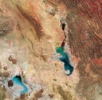
This Copernicus Sentinel-2 image features salt flats and lakes in southwest Bolivia, near the crest of the Andes Mountains. Acquired in April 2024, this false-color image shows part of the Oruro Department toward the southern end of the Altiplano, a high plain that stretches almost 1,000 kilometers from Peru to Bolivia. The image was processed using the near-infrared

Monday, April 29th, 2024
A study led by NASA researchers provides new estimates of how much water courses through Earth’s rivers, the rates at which it’s flowing into the ocean, and how much both of those figures have fluctuated over time—crucial information for understanding the planet’s water cycle and managing its freshwater supplies. The results also highlight regions depleted

Monday, April 15th, 2024
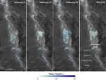
California’s Death Valley, the driest place in North America, has hosted an ephemeral lake since late 2023. A NASA-led analysis recently calculated water depths in the temporary lake over several weeks in February and March 2024, demonstrating the capabilities of the U.S.-French Surface Water and Ocean Topography (SWOT) satellite, which launched in December 2022. The analysis found

Tuesday, April 2nd, 2024
AccuWeather’s team of expert meteorologists is warning people and businesses to start preparing for a frenzy of tropical activity that could have major impacts on the United States this hurricane season. The AccuWeather 2024 Atlantic Hurricane Season Forecast calls for 20 to 25 named storms. Eight to 12 of those storms are forecast to strengthen into hurricanes. Four to six

Monday, March 18th, 2024
The European Commission (EC) and the European Space Agency (ESA) launched the Earth System Science Initiative to provide a coordinated response to critical environmental challenges and related scientific questions. The EC’s Research and Innovation Department and ESA’s Earth Observation Programmes Directorate are aligning a set of selected scientific activities under their respective Horizon Europe and
There are no upcoming events.
