Monday, December 18th, 2023
In the heart of California’s Central Valley, a groundbreaking agricultural revolution is underway. Gradient Crop Yield Solutions, a subsidiary of The Morning Star company, is leading the charge in transforming the way tomatoes are grown, using cutting-edge ground sensor technology and remote-sensing analytics to optimize irrigation practices. The satellite imagery provided by EOS Data Analytics

Monday, December 4th, 2023
As part of the long-standing partnership between NASA and Google, NASA worked with Google Arts & Culture and artist Yiyun Kang to create an interactive digital experience around global freshwater resources titled “A Passage of Water.” This immersive experience leverages data from the Gravity Recovery and Climate Experiment (GRACE) satellites and new high-resolution data from

Tuesday, November 21st, 2023
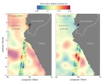
An analysis by NASA’s sea-level change science team finds that if a strong El Niño develops this winter, cities along the western coasts of the Americas could see an increase in the frequency of high-tide flooding that can swamp roads and spill into low-lying buildings. El Niño is a periodic climate phenomenon characterized by higher-than-normal

Tuesday, November 7th, 2023
Once it launches in early 2024, the NISAR radar satellite mission will offer detailed insights into two types of ecosystems—forests and wetlands—vital to naturally regulating the greenhouses gases in the atmosphere that are driving global climate change. NISAR, short for NASA-ISRO Synthetic Aperture Radar, is a joint mission by NASA and ISRO (Indian Space Research Organisation),

Sunday, October 22nd, 2023
A joint project of the French Government and Capture4Cad is using laser scanners from the Leica Geosystems’ BLK autonomous reality capture portfolio to create a comprehensive 3D model of the Citadelle de Besançon, France, a UNESCO World Heritage Site, while allowing visitors to immerse themselves in the area’s rich history. Digitalizing the citadel will help

Tuesday, October 10th, 2023
With applications ranging from agriculture to urban planning, the global aerial imaging market is poised for exponential growth. Experts predict that by 2032, the market size is set to surpass a staggering $25 billion. Expanding Applications Aerial imaging is finding applications in a diverse range of sectors. In agriculture, it aids in precision farming

Monday, September 25th, 2023
Methane is a powerful greenhouse gas and is the second-largest contributor to climate warming after carbon dioxide. A tonne of methane, despite its shorter lifespan of about 10 years in the atmosphere, can retain an astounding 30 times more heat than a tonne of carbon dioxide over the course of a century. This means that

Monday, September 11th, 2023
Harmful algae can endanger public health and coastal ecosystems and economies. Advances in satellite imaging are providing new ways to look at our living ocean. By the time they were over, a series of massive algal blooms along the west coast of Florida in 2020 would be linked to some 2,000 tons of dead marine

Monday, August 28th, 2023
NASA released the first data maps from its new instrument launched to space earlier in 2023, which now is successfully transmitting information about major air pollutants over North America. From its orbit 22,000 miles above the equator, NASA’s TEMPO, or Tropospheric Emissions: Monitoring of Pollution, is the first space-based instrument designed to continuously measure

Friday, August 11th, 2023
If global temperatures keep rising and reach 2 degrees Celsius (3.6 degrees Fahrenheit) above pre-industrial levels, people worldwide could face multiple impacts of climate change simultaneously. This is according to a NASA-led study that analyzed the projected impacts of such warming to understand how different climate effects might combine. A 2-degree rise in global temperatures is considered a
There are no upcoming events.
