
Tuesday, May 28th, 2024
With the Atlantic Hurricane Season beginning on June 1, 2024, AccuWeather expert meteorologists are concerned about a serious threat of rapidly intensifying storms during the 2024 Atlantic Hurricane season, which could leave families, businesses and government leaders with less time to react and prepare. Rapid intensification of tropical storms and hurricanes is defined as a
Monday, May 13th, 2024
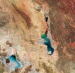
This Copernicus Sentinel-2 image features salt flats and lakes in southwest Bolivia, near the crest of the Andes Mountains. Acquired in April 2024, this false-color image shows part of the Oruro Department toward the southern end of the Altiplano, a high plain that stretches almost 1,000 kilometers from Peru to Bolivia. The image was processed using the near-infrared

Monday, April 29th, 2024
A study led by NASA researchers provides new estimates of how much water courses through Earth’s rivers, the rates at which it’s flowing into the ocean, and how much both of those figures have fluctuated over time—crucial information for understanding the planet’s water cycle and managing its freshwater supplies. The results also highlight regions depleted
Monday, April 15th, 2024
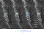
California’s Death Valley, the driest place in North America, has hosted an ephemeral lake since late 2023. A NASA-led analysis recently calculated water depths in the temporary lake over several weeks in February and March 2024, demonstrating the capabilities of the U.S.-French Surface Water and Ocean Topography (SWOT) satellite, which launched in December 2022. The analysis found

Tuesday, April 2nd, 2024
AccuWeather’s team of expert meteorologists is warning people and businesses to start preparing for a frenzy of tropical activity that could have major impacts on the United States this hurricane season. The AccuWeather 2024 Atlantic Hurricane Season Forecast calls for 20 to 25 named storms. Eight to 12 of those storms are forecast to strengthen into hurricanes. Four to six

Monday, March 18th, 2024
The European Commission (EC) and the European Space Agency (ESA) launched the Earth System Science Initiative to provide a coordinated response to critical environmental challenges and related scientific questions. The EC’s Research and Innovation Department and ESA’s Earth Observation Programmes Directorate are aligning a set of selected scientific activities under their respective Horizon Europe and
Tuesday, March 5th, 2024
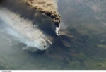
New research suggests that sunlight-blocking particles from an extreme eruption would not cool surface temperatures on Earth as severely as previously estimated. Some 74,000 years ago, the Toba volcano in Indonesia exploded with a force 1,000 times more powerful than the 1980 eruption of Mount St. Helens. The mystery is what happened after that—namely, to
Friday, February 16th, 2024
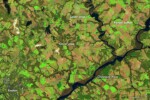
For the second year in a row, farmers in Maryland planted a record amount of winter cover crops in 2016-17. These cold-tolerant crops—including wheat, rye, barley and radish—are planted in the fall. In addition to increasing soil health and boosting yields, cover crops reduce soil erosion and absorb nutrients such as nitrogen that could otherwise affect water quality
Monday, February 5th, 2024
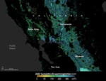
As the world looks for sustainable solutions, a system tapping into NASA satellite data for water management has passed a critical test. Called OpenET, the system uses an ensemble of six satellite-driven models that harness publicly available data from the Landsat program to calculate evapotranspiration (ET)—the movement of water vapor from soil and plant leaves

Tuesday, January 16th, 2024
R-evolution, Hexagon’s sustainable innovation and green-tech investment subsidiary, launched its forest initiative Green Cubes to accelerate biodiversity rainforest conservation worldwide. Using Hexagon’s reality capture technology to accurately measure and visualise the volume and complexity of the rainforest in 3D, R-evolution is enabling corporations to sponsor rainforest segments on a cubic-meter basis. The world’s first Green
There are no upcoming events.
