Thursday, September 1st, 2016
Disasters and emergencies can happen at any time, often without warning. Natural hazards threaten thousands of lives and cause billions of dollars in damage every year throughout the nation. September is National Preparedness Month, a time to highlight the resources available to help you and your loved ones stay as safe as possible. This article

Tuesday, August 30th, 2016
A 6.2 magnitude earthquake struck central Italy on Aug. 24, 2016. Approximately 300 people died as a result of the quake, which devastated several towns in the country’s Apennine mountain belt. The Italian peninsula features fault lines created by the separation of the African and Eurasian tectonic plates. The fault line separating these two plates

Tuesday, August 23rd, 2016
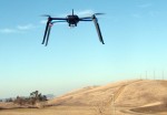
The National League of Cities (NLC) released Cities and Drones, a new report that provides cities with insight on the recently released Federal Aviation Administration (FAA) rules relating to drone operation. The report also provides suggestions for how local governments can craft their own drone ordinances to encourage innovation while protecting their cities. In addition

Tuesday, August 16th, 2016
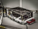
Construction of NASA’s Dellingr CubeSat is complete, and the satellite now is ready for environmental testing. Named for the god of dawn in Norse mythology, Dellingr will study the ionosphere—the outer region of Earth’s atmosphere populated by charged particles ionized by incoming solar radiation and magnetospheric particle precipitation. Slightly larger than a cereal box, Dellingr

Tuesday, August 9th, 2016
The pioneering Aladin sensor, a spaceborne LiDAR instrument with two powerful lasers, a large telescope and very sensitive receivers, is ready to join its Aeolus satellite for launch in 2017. Designed by Airbus Defence and Space, Aladin’s laser generates ultraviolet light beamed toward Earth, which bounces off air molecules and small particles such as dust,

Tuesday, August 2nd, 2016
NASA scientists and engineers are field testing the CO2 Sounder LiDAR, an instrument powerful and accurate enough to gather around-the-clock global atmospheric carbon-dioxide (CO2) measurements from space. The instrument is a strong contender for a potential next-generation carbon-monitoring mission, the Active Sensing of CO2 Emissions over Nights, Days and Seasons (ASCENDS). The LiDAR operates by

Tuesday, May 31st, 2016
Paris, Washington D.C., Montreal, Yokohama, May 31, 2016 – According to Euroconsult’s latest report, Prospects for Remotely Piloted Aircraft Systems, the size of the professional RPAS (Remotely Piloted Aircraft Systems) manufacturing and services market is expected to grow significantly in the next ten years, from $1 billion in 2015 to $26 billion in 2025. The civil

Monday, March 28th, 2016
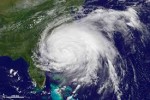
The launch of the GOES-R geostationary satellite in October 2016 could herald a new era for predicting hurricanes, according to Penn State researchers. The wealth of information from this new satellite, at time and space scales not previously possible, combined with advanced statistical hurricane prediction models, could enable more accurate predictions in the future. “For

Monday, February 22nd, 2016
The U.S. Environmental Protection Agency today released an online mapping tool that provides users with information about their watershed and water supplier, as well as information about any possible sources of pollution that could affect their communities’ water supply.

Monday, February 15th, 2016
Fitchburg, MA, February 15, 2016 — Headwall Photonics, Inc., the leading provider of spectral imaging solutions, has introduced a new, powerful data processing unit specifically designed for UAV airborne applications requiring sensor fusion. The small size and weight of HyperCore combined with its powerful data processing and high capacity storage connections offers the industry’s only processing