Tuesday, July 24th, 2018
UK laser scanning and monitoring companies 3D Laser Mapping Ltd. and GeoSLAM Ltd. merged to take advantage of new world market opportunities and increased R&D capability as well as ensure greater market reach. The newly merged companies will trade as GeoSLAM Ltd. “This merger will combine the best of two leading organizations with strong global

Tuesday, July 17th, 2018
India’s southwest monsoon normally occurs between June and September and is known for being a summertime rainy season. This year’s monsoon has been assessed as average, but India’s Meteorological Department statistics show that daily mean rainfall for the country has recently been above normal. At least 15 people were killed by floods and landslides in

Tuesday, July 10th, 2018
Representatives of 23 national organizations joined together to sign a letter in support of the 3D Elevation Program (3DEP) to newly confirmed USGS Director, Dr. James Reilly. Reilly was nominated by President Trump on Jan. 26, 2018, confirmed by the U.S. Senate on April 9, and took office as the 17th Director of USGS on

Wednesday, July 4th, 2018
The laser ranging interferometer (LRI) instrument has been successfully switched on aboard the recently launched twin U.S./German Gravity Recovery and Climate Experiment Follow-On (GRACE-FO) satellites. The LRI, which is being flown as a technology demonstration, made its first measurements in parallel with GRACE-FO’s main microwave ranging instrument, and initial comparisons of the data from the

Tuesday, June 26th, 2018
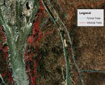
Most visitors to protected natural areas hike on trails created with hardened treads designed to sustain traffic. However, heavy hiking traffic and use by mountain bikers, motorized vehicles and horseback riders all take their toll. Parks also are becoming more crowded, with long lines of trail users during the popular summer season. More visitors have

Sunday, June 17th, 2018
Ice losses from Antarctica have tripled since 2012, increasing global sea levels by 0.12 inches (3 millimeters) in that timeframe alone, according to a major new international climate assessment funded by NASA and the European Space Agency (ESA). According to the study, ice losses from Antarctica are causing sea levels to rise faster today than

Tuesday, June 12th, 2018
Portal Produtos Agropecuários Ltda in Brazil is using SimActive photogrammetry software in its precision agriculture efforts. Drone data are transformed into useful and pertinent information for farmers with Correlator3D, leading to optimized yields and reduced costs for the agricultural season. The identification of the presence and damage caused by centipedes was one such example. When

Tuesday, June 5th, 2018
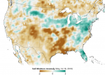
Data from the first NASA satellite mission dedicated to measuring the water content of soils is now being used operationally by the U.S. Department of Agriculture to monitor global croplands and make commodity forecasts. The Soil Moisture Active Passive (SMAP) mission launched in 2015 and has helped map the amount of water in soils worldwide.