Sensors and Systems
Breaking News
The Release of UgCS 5.0 is Setting New Standards in Drone Flight Planning
The most significant release of UgCS, the best and...
ModalAIⓇ Launches Next Generation Starling 2 and Starling 2 Max NDAA-Compliant Development Drones
SAN DIEGO – ModalAI, Inc. today announced Starling 2...
Draganfly, Doodle Labs, and UXV Technologies Collaborate to Enhance UAV Communication Solutions
Innovative Collaboration Between Draganfly, Doodle Labs, and UXV Technologies...

Featured

image

Tuesday, October 24th, 2017

IAFC Partners with Intermedix and Esri to Build National Mutual Aid System

The International Association of Fire Chiefs (IAFC), Intermedix and Esri agreed to build the National Mutual Aid System (NMAS), the next-generation version of IAFC’s Mutual Aid Net tool built in 2008. The NMAS will use Esri’s ArcGIS platform and Intermedix’s WebEOC software to manage and track emergency services resources during mutual aid responses. During large-scale

Tuesday, October 17th, 2017

Drones Help with California Wildfires

In support of CAL FIRE’s firefighting efforts in Northern California, the California Air National Guard’s 163d Attack Wing operating out of March Air Reserve Base is using MQ-9 Unmanned Aircraft Systems (UASs) with full-motion video (optical and infrared) and ground imaging Synthetic Aperture Radar (SAR) capability, which can see through clouds and smoke. “The 163d

Monday, October 9th, 2017

Satellites Provide Thermal View of Hurricane Nate after Landfall

NASA’s Aqua satellite and NASA-NOAA’s Suomi NPP satellite analyzed the temperatures in Hurricane Nate’s cloud tops and determined that the most powerful thunderstorms and heaviest rain areas were around the center of the tropical cyclone after it made landfall near the mouth of the Mississippi River on Oct. 7, 2017. Infrared light provides valuable temperature

Tuesday, October 3rd, 2017

Kenyan Government Mapping Mines with Photogrammetry Software

The Directorate of Resource Surveys & Remote Sensing (DRSRS) under the Ministry of Mining in Kenya is using SimActive’s Correlator3D for extensive mapping of mining activities. The software generates orthomosaics, contour lines and digital terrain models of fluorspar mines in the Kerio valley in Kenya. “The DRSRS provides the Ministry of Mining with spatial information,
Sunday, October 1st, 2017

GIS to the Rescue: Unleashing the Power of Geospatial Technology to Plan for and Respond to Natural Disasters

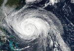
By Dr. Ahmed Abukhater As Hurricane Harvey made landfall on the Texas Gulf Coast on Aug. 25, 2017, with winds topping 130 miles per hour, the situation signaled a disaster on the horizon. The winds and heavy rains caused significant flooding, toppled branches and power lines, and lead to massive blackouts across the region. With
Monday, September 25th, 2017

Forest Fire Pollution Wreaks Havoc on Wildlife

Forest fires in Southeast Asia during the El Niño droughts of 2015 caused considerable disruption to the biodiversity of the region due to the smoke-induced haze they created, according to new research published in the Environmental Research Letters journal and led by Benjamin Lee at the University of Kent and the National Parks Board in

Monday, September 18th, 2017

NASA Flights Map Summer Melt of Greenland Ice

Operation IceBridge is flying in Greenland to measure how much ice has melted during the summer. The flights, which began on Aug. 25, 2017, and will go on until Sept. 21, 2017, repeat paths flown this spring and aim to monitor seasonal changes in the elevation of the ice sheet. “We started to mount these

Monday, September 11th, 2017

Darkness Blooms off Brazil

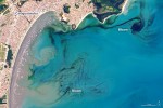
In early September 2017, ocean scientists noticed something swirling in the waters off the coast of the Brazilian state of São Paulo. The sinuous threads of darkness amid the blue Atlantic Ocean were not caused by oil; they were the result of a phytoplankton bloom. The dark colors are probably high concentrations of dinoflagellates, according

Tuesday, September 5th, 2017

GISCorps Rallies Hurricane Harvey Response

The impacts of Hurricane Harvey are being felt far and wide. As the rain continued to fall, and flood waters rose, an army of citizen-rescuers answered the call. And as governments encouraged citizens to help one another, the non-profit organization made up of mapping experts also answered the call. GISCorps, a program of the Urban

Monday, August 28th, 2017

Taking a Page from GPS History in Building ‘Zero-Code’ Solutions

By Mike Gundling  Ever since the first GPS satellite went aloft–and especially since the first smartphones and tablets provided GPS positioning–government, industry and academia have been in a never-ending search for new ways to use location-based data. Environmental organizations conduct wetland delineation surveys. Transportation companies track trucks and trains. Public-service officials seek law-enforcement and emergency

Page 23 of 30 1 18 19 20 21 22 23 24 25 26 27 28 30