Tuesday, May 28th, 2019
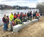
U.S. Geological Survey (USGS) and independent scientists gathered in Auburn, Maine, to evaluate the use of sensor-mounted unmanned aircraft systems (UAS), or drones, to gauge stream stage, velocity, bathymetry and discharge. The technology is being evaluated and modeled to determine whether it will support the fast, accurate and safe measurement of rivers, especially when they

Monday, May 20th, 2019
In the aftermath of natural disasters, capturing image data is a critical information resource for disaster management, supporting the response effort to deliver emergency infrastructures and supplies, risk assessment, damage assessment for cost estimation, structural analysis, and beyond. After Hurricane Michael in 2018 and a devastating tornado in Alabama in 2019, Site Tour 360 visited

Tuesday, May 14th, 2019
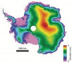
Ice is a hot topic when it comes to understanding and monitoring how this fragile component of the Earth system is being affected by climate change. Scientists go to great lengths to study changes happening in the remote icy reaches of our planet–a subject that is being discussed in detail at the Living Planet Symposium

Thursday, May 2nd, 2019
A map of trees supplied by aerial mapping company Bluesky is playing an important role in an innovative project to reduce flooding via natural flood-management techniques around the Spains Hall Estate in Essex. Working alongside engineering company Atkins, the Environment Agency, Essex and Suffolk River Trust and Essex Wildlife Trust, the Estate is looking to

Tuesday, April 30th, 2019
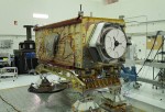
When the Orbiting Carbon Observatory 3 (OCO-3) heads to the International Space Station, it will bring a new view to studies of Earth’s carbon cycle. From its perch on the space station, OCO-3 will observe near-global measurements of carbon dioxide on land and sea, from just after sunrise to just before sunset. That makes it

Wednesday, April 24th, 2019
Brazil’s National Civil Aviation Agency (ANAC) approved Beyond Visual-Line-Of-Sight (BVLOS) flights to be carried out in Brazil for the first time in the country’s history, using senseFly’s proprietary drone technology. As the first BVLOS approval ever achieved in the country, the announcement marks a pivotal point in Brazil’s commercial drone industry and will play an

Tuesday, April 16th, 2019
NASA’s Global Ecosystem Dynamics Investigation (GEDI) mission launched in December 2018. From its perch aboard the International Space Station, GEDI’s powerful lasers create detailed 3D maps of Earth’s forests and topography, providing innovative and unique spaceborne observations. In January 2019, GEDI’s lasers were turned on for the first time, and the instrument is now giving

Tuesday, April 9th, 2019
Northern peatlands store approximately one third of global soil carbon, approximately 500 gigatons. Because the peatland carbon cycling is largely controlled by partly anaerobic soil conditions, the carbon stored in these soils is extremely vulnerable to climate warming that is expected to reduce soil moisture and therefore increase soil aeration. Understanding the interactions between warming

Tuesday, April 2nd, 2019
An Italian Space Agency Earth observation mission will capture data on the chemical make-up of objects through a powerful hyperspectral imager built by Leonardo, which includes two Sofradir detectors. The PRISMA (PRecursore IperSpettrale della Missione Applicativa) satellite was launched on the Vega rocket from the Kourou, French Guiana, Space Center on March 22, 2019. PRISMA

Tuesday, March 26th, 2019
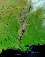
At least 200 gauges along the waterways of the Central United States—especially the Missouri and Mississippi river basins—reported some level of flooding on March 23, 2019. Thirty-six stations reported major flooding, and another 79 reported moderate floods. Historically high water levels could be a factor in the region for weeks, according to government forecasts. The
There are no upcoming events.
