Tuesday, January 7th, 2020
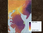
Trying to gauge soil moisture across large areas—regions, nations, continents—is difficult, yet knowledge of this dimension of our ecosystem is extremely important for farmers, planners, scientists, insurance companies and anyone concerned about preparing for global environmental change. “Understanding these patterns is critical to national and international security,” said Rodrigo Vargas, associate professor of ecosystem ecology

Monday, December 16th, 2019
The Greenland Ice Sheet is rapidly melting, having lost 3.8 trillion tons of ice between 1992 and 2018, a new study from NASA and the European Space Agency (ESA) finds. The study combined 26 independent satellite datasets to track global warming’s effect on Greenland, one of the largest ice sheets on Earth, and the ice

Tuesday, December 10th, 2019
If coral reefs are the canary to the ocean’s coal mine, it’s getting awfully bleak in the Gulf of Mexico. A new study by Rice University Earth scientists asserts: Without a rapid and dramatic reduction of greenhouse gas emissions, fragile coral reefs in the Gulf of Mexico, like those around the world, face catastrophe. That

Tuesday, December 3rd, 2019
The salinity of the ocean surface can be monitored from space using satellites to give a global view of the variable patterns of sea-surface salinity across the oceans. Unusual salinity levels may indicate the onset of extreme climate events, such as El Niño. Global maps of sea-surface salinity are particularly helpful for studying the water

Monday, November 25th, 2019
Major U.S. cities may be leaking far more methane into the atmosphere than government estimates suggest. New measurements found that up to twice as much gas is being released from six cities on the East Coast—Washington, D.C.; Philadelphia; Boston; New York; Providence, R.I.; and Baltimore—than estimates recorded by the Environmental Protection Agency (EPA). Their combined

Tuesday, November 19th, 2019
A historical archaeologist made a surprising discovery about daily life in an 1800s gold mining town by mapping artifacts in the Surfer scientific modeling package from Golden Software. Artifact distribution maps indicate Highland City, Mont., may have been a well-integrated town for its time. “Overseas Chinese immigrants worked in the mines of the American West

Tuesday, November 12th, 2019
A NASA-funded study suggests winter carbon emissions in the Arctic may be adding more carbon into the atmosphere each year than is taken up by Arctic vegetation, marking a stark reversal for a region that has captured and stored carbon for tens of thousands of years. The study, published Oct. 21, 2019, in Nature Climate

Tuesday, November 5th, 2019
NASA has for years used its cutting-edge space-based and airborne instruments to better understand hurricanes and give weather forecasters new insights they could use to improve the accuracy of their storm forecasts. A NASA program focused on bringing new weather research to bare on forecasting challenges is now tackling predictions of a hurricane’s strength. The

Tuesday, October 29th, 2019
Data from the Sentinel-3 World Fire Atlas shows that there were almost five times as many wildfires in August 2019 compared to August 2018, but a detailed analysis reveals precisely where these fires have been occurring, most of which were in Asia. The Copernicus Sentinel-3 mission recorded 79,000 fires in August this year, compared to

Monday, October 21st, 2019
Abnormal weather patterns in the upper atmosphere over Antarctica dramatically limited ozone depletion in September and October, resulting in the smallest ozone hole observed since 1982, NASA and NOAA scientists reported. The annual ozone hole reached its peak extent of 6.3 million square miles (16. 4 million square kilometers) on Sept. 8, 2019, and then
There are no upcoming events.
