-
July 22nd, 2025
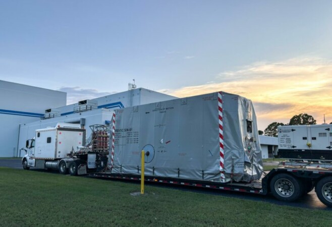
Space Weather Satellite Makes Final Stop in FloridaThe National Oceanic and Atmospheric Administration’s (NOAA) Space Weather Follow On–Lagrange 1 (SWFO-L1) Observatory, set to provide quicker and more accurate space weather forecasts, arrived Sunday, July 20, 2025, at the Astrotech Space Operations Facility near NASA’s Kennedy Space Center in Florida. The SWFO-L1 mission will monitor the Sun and near-Earth environment using a suite
-
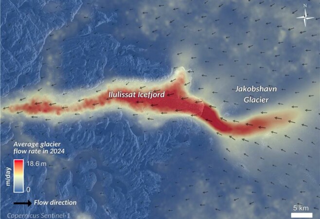
Melting glaciers worldwide are significant indicators of climate change, revealing dynamic shifts in Earth’s environment. Satellite technology plays a crucial role in tracking these changes by measuring glacier movement and mass balance to assess climate impacts. Glaciers are dynamic and sensitive geosystems that respond to human-driven climate changes, constantly moving and evolving rather than being
-

June 23rd, 2025
Predicting Underwater Landslides Before They StrikeBelow ocean wind farms, oil rigs and other offshore installations are mammoth networks of underwater structures, including pipelines, anchors, risers and cables, that are essential to harness the energy source. But much like terrestrial structures, these subsea constructions are also vulnerable to natural events, like submarine landslides, that can hamper the productivity of installations below
-
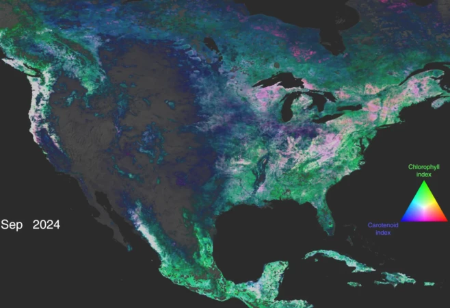
A lot can change in a year for Earth’s forests and vegetation, as springtime and rainy seasons can bring new growth, while cooling temperatures and dry weather can bring a dieback of those green colors. And now, a novel type of NASA visualization illustrates those changes in a full complement of colors as seen from
-->