
Wednesday, July 9th, 2014
Many reports in the Chinese media have indicated that Alibaba, China’s largest e-commerce site that is on an investment spree, will team with State-owned China North Industries Group to promote the commercial uses of the Beidou navigation system. The investment has been reported at 1 billion yuan ($160 million) according to Dazhihui News Agency.

Sunday, January 22nd, 2012
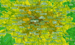
The INSPIRE Directive considers that spatial information is needed for the implementation of Community policies which must integrate environmental protection in accordance with Article 6 of the Treaty, and establishes the basis for an infrastructure for spatial information in Europe in order to support EU environmental policies and those activities which may have an impact

Monday, November 21st, 2011
Founded in 1985, ECTP-CEU (European Council of Spatial Planners-Conseil européen des urbanistes) brings together 25 professional town planning associations and institutes from 23 European countries as well as corresponding members. It is an umbrella association providing its members with a common framework for planning practice, planning education, continuing professional development and the definition of professional

Monday, November 14th, 2011
Supply chains include both upstream and downstream relationships involving goods, services and customers. The delivery of geographic information (GIS) will necessarily include each of these. The Supply-Chain Operation Reference (SCOR) Model can be used to interpret and understand geospatial supply chains. The mapping of the various processes will assist a GIS unit to understand the processes involved
Saturday, October 15th, 2011
Mapumental is a start up of mySociety, the organisation that builds award-winning non-profit websites and carries out commercial work for clients such the BBC, The Guardian, Google, and national and local government. In 2007 the project started develop prototypes for real time maps that could handle huge amounts of travel data. In 2009 it won
Wednesday, September 21st, 2011
Planning and mainly spatial planning deals with the spatial dimension of development. It is concerned not only with architecture but also with the place where people live and work. Spatial planning is one of the major challenges facing Europe. In the future it won’t be possible to solve planning problems of regional development without access to spatial knowledge. Good

Tuesday, August 30th, 2011
Sustainable tourism is an important aspect of many European countries and regions. It plays a crucial role in parks, protected areas and coastal zones. To be able to guarantee tourism activities and development in regions, public servants have to be trained about potential influence of investment in tourism on the environment. Nature protection and support
Tuesday, August 9th, 2011
Scientists of the TU Darmstadt are working on the Smart City. Smart phones, equipped with numerous sensors, significantly simplify for their owners the organization of several aspects of their lives. But this is only the beginning; scientists of Darmstadt envision an entire smart city in which all sensor-equipped devices are interlinked in an intelligent manner.

Sunday, June 19th, 2011
Water is an invaluable resource; already in 1992 it took centre stage at the first international conference of the United Nations on environmental protection and sustainability. The United Nations have declared the years 2005 to 2015 to be the international “Water for Life” Decade.

Thursday, June 16th, 2011
The concepts of integration, complementarity and coordination are particularly important especially in the field of railway infrastructures. The requirements of the associated interventions are very technical in nature and involve multiple specialties and technologies, and the final result is only guaranteed if the various components of this interwoven puzzle are compatible and properly joined together.
