Wednesday, September 28th, 2016
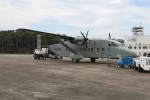
NASA is conducting low-level aircraft flights measuring greenhouse gases over the U.S. mid-Atlantic region for the CARbon Airborne Flux Experiment (CARAFE), which will measure the exchange of greenhouse gases such as carbon dioxide and methane between Earth and the atmosphere. Water vapor, temperature and vertical wind measurements also will be taken. “The direct measurements of

Tuesday, September 20th, 2016
A laser scanner mounted to ships and submarine vehicles is providing high-resolution images of underwater features, including shipwrecks. The ULS-500 PRO scanner from 2G Robotics uses a high-sensitivity, low-noise sensor to reach ranges previously unattainable with laser scanning, resolving fine-scale dimensional features from distances as far as 20 meters. The system was used offshore during

Tuesday, September 20th, 2016
Montreal, Canada, September 20th, 2016 – SimActive Inc., a world-leading developer of photogrammetry software, is pleased to announce Correlator3D™ version 6.5 with a new picture-in-picture (PiP) feature. The PiP brings a 3D rendered view of projects through an inset window, visible at all times to streamline processing and editing. The interactive viewing capability allows display

Thursday, September 15th, 2016
Washington, DC — At seven feet tall and featuring 55-inch screens, the 30 kiosks coming to downtown D.C. will be much more than glorified digital ad machines. Designed by New York–based Smart City Media, the kiosks will feature timely information relating to nearby restaurants, retail, events, and public transportation. This pilot program is led by

Wednesday, September 14th, 2016
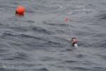
Using a new system of drifting buoys, scientists from NOAA’s Southwest Fisheries Science Center in La Jolla, Calif., will have a much better chance of hearing beaked whales in their deep-water habitat off the West Coast. About 20 buoys will be deployed from a NOAA ship with a listening device suspended 330 feet below the

Thursday, September 8th, 2016
The National Geospatial-Intelligence Agency (NGA) and the National Science Foundation (NSF) released new 3-D topographic maps of Alaska on Sept. 1, 2016, in support of a White House Arctic initiative to inform better decision-making in the area. The 3-D digital elevation models (DEMs) are the first to come from the ArcticDEM project, which was created

Thursday, September 1st, 2016
A SpaceX rocket exploded at its Cape Canaveral launch pad Thursday morning, destroying the rocket and the satellite it was due to launch on Saturday. SpaceX said there were no injuries as a result of the explosion, which it described as an “anomaly.” SpaceX CEO Elon Musk tweeted that the explosion happened while the rocket

Thursday, September 1st, 2016
Disasters and emergencies can happen at any time, often without warning. Natural hazards threaten thousands of lives and cause billions of dollars in damage every year throughout the nation. September is National Preparedness Month, a time to highlight the resources available to help you and your loved ones stay as safe as possible. This article

Tuesday, August 30th, 2016
A 6.2 magnitude earthquake struck central Italy on Aug. 24, 2016. Approximately 300 people died as a result of the quake, which devastated several towns in the country’s Apennine mountain belt. The Italian peninsula features fault lines created by the separation of the African and Eurasian tectonic plates. The fault line separating these two plates

Tuesday, August 23rd, 2016
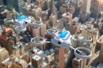
The National League of Cities (NLC) released Cities and Drones, a new report that provides cities with insight on the recently released Federal Aviation Administration (FAA) rules relating to drone operation. The report also provides suggestions for how local governments can craft their own drone ordinances to encourage innovation while protecting their cities. In addition