Tuesday, August 9th, 2011
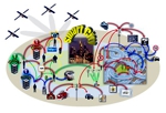
Scientists of the TU Darmstadt are working on the Smart City. Smart phones, equipped with numerous sensors, significantly simplify for their owners the organization of several aspects of their lives. But this is only the beginning; scientists of Darmstadt envision an entire smart city in which all sensor-equipped devices are interlinked in an intelligent manner.

Monday, July 18th, 2011
In recent years, EPCOR Water Services of Edmonton, Alberta, Canada has run highly visible city-wide water conservation campaigns. EPCOR Water serves 1 million customers with 240,000 fully metered service connections, 2 water treatment plants, and 3,500 km of pipeline. Along with raising water conservation awareness, the campaigns were specifically designed to reduce summer demand. Limited
Monday, June 27th, 2011
On September 9, 2010, a gas transmission pipeline rupture in San Bruno, California, killed eight people and caused extensive property damage. The subsequent National Transportation Safety Board (NTSB) investigation revealed that some records in the operator’s Geographic Information System (GIS) were inaccurate. The finding is significant because federal law requires pipeline operators to perform data-driven

Sunday, June 19th, 2011
Water is an invaluable resource; already in 1992 it took centre stage at the first international conference of the United Nations on environmental protection and sustainability. The United Nations have declared the years 2005 to 2015 to be the international “Water for Life” Decade.

Thursday, June 16th, 2011
The concepts of integration, complementarity and coordination are particularly important especially in the field of railway infrastructures. The requirements of the associated interventions are very technical in nature and involve multiple specialties and technologies, and the final result is only guaranteed if the various components of this interwoven puzzle are compatible and properly joined together.

Tuesday, May 17th, 2011
Effective spatial data management is essential to government administration at all levels from local to national. The City of Springfield and NASA Ames Research Center have begun collaboration on the technology and framework needed for sustainable spatial data management across all levels of government. This technology is open source and purposed to enhance the sharing

Wednesday, April 6th, 2011
Recently, a national CORS network, called CORS-TR network has been established by Istanbul Kultur University in Turkey and Northern Cyprus. The project was sponsored by the Scientific and Technological Research Council of Turkey (TUBITAK). The network was designed to fulfill several important tasks ranging from geodetic measurements, crustal deformation studies to modeling the atmosphere (troposphere

Sunday, April 3rd, 2011
That GIS products and technologies will adopt 3D for visualization and analysis is a foregone conclusion. Possibly the biggest clue that geospatial 3D is going to be perceived in the future as just another flavor of the map interface is the simple one-click toggle between Google Maps and Google Earth that was introduced a couple

Sunday, March 20th, 2011
One of the biggest issues or discussion subject within the whole geographic information domain at the moment is the ever-changing demands for handling information in a better and more efficient way. The domain is expanding in all kinds of directions. What remains is geo-referenced information handled with a computer. We are seeing applications and demonstrators

Thursday, February 24th, 2011
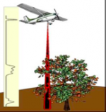
In 2010, an innovative technology began assisting with the assessment of existing forest conditions as well as establishing a viable approach to long-term monitoring to support the management of natural forests in Indonesia. With the ability to rapidly collect highly accurate three-dimensional information of the forest from aircraft flying at three-quarters of a kilometer above