 Effective spatial data management is essential to government administration at all levels from local to national. The City of Springfield and NASA Ames Research Center have begun collaboration on the technology and framework needed for sustainable spatial data management across all levels of government. This technology is open source and purposed to enhance the sharing of data and the functionalities needed to administer that data.
Effective spatial data management is essential to government administration at all levels from local to national. The City of Springfield and NASA Ames Research Center have begun collaboration on the technology and framework needed for sustainable spatial data management across all levels of government. This technology is open source and purposed to enhance the sharing of data and the functionalities needed to administer that data.
Spatial Data Infrastructure Northwest (SDI-Now) is the grass roots initiative to facilitate participation in a sustainable development of spatial data management tools that will service government agencies and the private sector. This effort is strategically aligned with the National Spatial Data Infrastructure (NSDI) Executive Order 12906 that addresses “technologies, policies, and people necessary to promote sharing of geospatial data throughout all levels of government, the private and non-profit sectors, and the academic community”. This initiative advances projects such as ‘Virtual USA’ and relies heavily on open source solutions and innovative collaboration to facilitate sharing of local facilities information. SDI-Now provides the public infrastructure to service public facilities information.
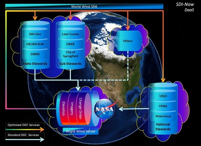
SDI-Now takes advantage of NASA’s World Wind, a mature and attractive Open Source software (OSS) product well suited to support local as well as national needs.
Toward Greater Collaboration
Innovative collaboration is not new to Oregon as mapping specialists in the state have been sharing information successfully for nearly three decades under the region’s Common Mapping Cooperative Project Agreement (CPA), an intergovernmental agreement between the City of Springfield, City of Eugene, Lane County and the Eugene Water and Electric Board (EWEB). Under the recent CPA Parcel Maintenance Plan, processing effort was cut 66%, posting time was cut 25%, production costs were reduced $50,000 per year, while map resolution increased from one-hundred feet to less than one-foot.
This multi-jurisdictional collaboration has rapidly advanced access to multiple categories of shared mapping information including jurisdictional boundaries, public facilities and natural resources. Unfortunately, these gains have been confined primarily to business functions between collaborating CPA participants. External parties needing the same type of access to the same information must still rely on cumbersome data request forms and then time consuming manual processing services to access and provide the information in those requests. This expense is in addition to the costly proprietary software applications needed to use this public information.
Regional 3D perspectives of four framework themes: Elevation, Hydrography, Cadastral, and Facilities (facilities in this case being buildings and storm water conveyance system).
To overcome information management issues, each local, state and national entity independently pursues their own path. These non-interoperable commercial solutions tend to make each client beholden to each vendor’s business model, which increasingly limits the possibilities. This approach requires substantial funding for hardware and software procurement, annual license fees, consultant fees and specialized administration staff. Once installed, disparate mapping units must purchase additional software just to exchange mapping data with other software systems, peripheral devices and data collection tools. Given these ‘locked-in’ costs versus the realization that the same system (hardware, software, data, and support services) can be shared over a much larger user community, the pursuit of open source technologies and shared services has become financially attractive if not a financial imperative.
NASA’s World Wind is a mature and attractive Open Source software (OSS) product well suited to support local as well as national needs for mapping services and is specifically designed to overcome data sharing hurdles. World Wind won the prestigious “NASA Software of the Year” in 2010 for supporting open protocols for data sharing and providing advanced spatial data management functionality. A robust and well-established open community currently collaborates on development. Of the established OSS products, World Wind is well suited to overcome key hurdles local, state and national communities face in managing mapping data.
Doing More with Less
As local budgets and staffing decline, and local agencies struggle to sustain high levels of service, reliance on collaborative partners becomes increasingly necessary. External partners such as the private, non-profit and academic sectors acquire, analyze, prepare and share much information with local governments. By providing an open platform for spatial data, the viability for external partners to provide competitive solutions dramatically increases.
As national programs target local communities to stimulate job growth, increase government transparency and higher levels of government efficiency, the need for increasingly better tools to manage local mapping information increases, which in turn will drive the local business community to provide solutions. Innovative open platforms for solutions such as SDI-Now will stimulate new markets, provide affordable solutions to engage local communities, enhance access local mapping information, and support targeted advances toward key initiatives.
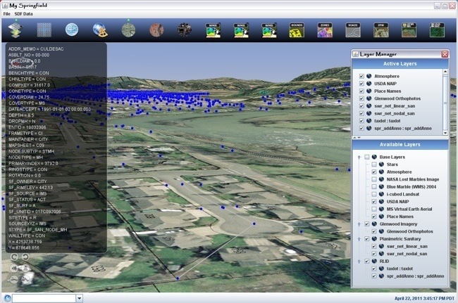
The City of Springfield has implemented a rich geovisualization and analysis site called My Springfield that was built with open source software.
SDI-Now addresses a clear set of shared business needs:
Mapping information specialists often re-create, re-analyze, re-convert and then re-disseminate the same information multiple times, often using proprietary solutions that cannot then be more effectively shared and further advanced. This approach places artificial restrictions on the flow of mapping information, limits development of additional solutions and requires redundant resources to sustain. Transformational change is needed to advance from the stove-piped world where efforts are wastefully duplicated to a more collaborative environment where efforts are additive and synergistic.
Ensuring Access
Simply put, the costs of independent implementation of interconnected commercial mapping systems exceed the capacity of many smaller organizations. Many local governments, local engineering firms, local surveying firms, local planning firms and local colleges lack sufficient funding to participate on their own. As a result, larger public organizations with sufficient funding tend to dominate the market, dictate the rules, perform the analysis, produce the maps and essentially control systems that silo public information – publishing and brokering information as they deem appropriate. This arrangement relies on independent funding sources, fosters independent software development, favors those with the most resources, and denies opportunities to smaller agencies. Leveraging cross-agency collaboration lowers net cost, increases efficiency and levels the playing field.
Open source software is creating a sea change in how software technology advances for large segments of the world’s population. The open source software movement is fostering new cultural exchange networks, social networks and collaborative crisis centers that are engaging talented youth across the world. The CrisisCamp Haiti earthquake response is a prime example where distributed teams, using World Wind and other tools, were working simultaneously at Portland State University in Oregon, the World Bank in Washing D.C., the Sunnyvale Campus in Silicon Valley, and many other locations around the world. The barrier-free and collaborative nature of open source software helped make this effort possible.
While the pursuit of open source software (OSS) foregoes software purchasing and licensing cost, it’s important to note that other costs remain and that free software does not equate to free service for all. It does mean that once a system is operational, adding more clients can be free, adding functionality developed by others can be free, and that the user community has more control over containing the longer-term costs. To provide some context, it’s not uncommon for a medium sized mapping unit supporting 30-40 users to program $45,000 per year for mapping software licensing and an additional $15,000 to $20,000 per year for mapping software purchasing. Even modest reductions across a relatively small number of cities will produce significant cost savings. For small cities with no budget for mapping software, SDI-Now could provide previously unachievable access.
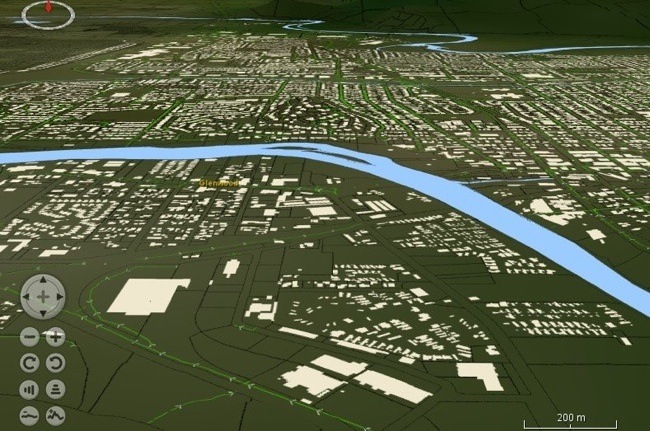
This image clearly illustrates the advantage of local data with the top image based on national data versus the local view below.
Recognizing the benefit to our external partners, professional communities trying to support local governments, the benefit to small businesses trying to access public information, the benefit to the public servants trying to provide that information, the benefit of containing spiraling costs, the benefit of reducing unnecessary duplication, and the benefit of advancing a key national initiative, we believe that now is the time to move forward and that SDI-Now identifies where we are and where we need to be . . . in order to best serve mapping needs across the nation. We seek your participation in this collaboration between local governments in Oregon and the NASA Ames Research Center in California.
We believe that the timing is right to move forward on SDI-Now to increase collaboration between local governments, to provide greater public information access for small businesses, and to reduce costs while improving efficiency. We seek your involvement in this local strategic planning initiative in order to advance collaborative local, state and national mapping technology.
Brandt Melick in Technical Services Division Manager in the Public Works Department at the City of Springfied, Oregon; e-mail: [email protected]. Patrick Hogan is NASA World Wind project manager at NASA Ames Research Center in Moffett Field, Calif.; e-mail: [email protected].
SIDEBARS
Supporting Diverse Data Needs
Business Need: Local communities need viable methods to collaborate with local facilities information in a variety of electronic formats. Sharing information about wastewater systems, storm drainage systems, natural resources, street networks and the spatial relationship of these facilities to land records such as parcels, easements, rights of ways and improvement agreements occur on a daily basis. This information takes many forms, including but not limited to a variety of image, tabbed, text and video based products such as spreadsheets, data collector files, plan sets, TV reports (videos taken within pipes) and documentation that provide narrative.
SDI-NoW Approach: Prototyping simple tools to access GIS exchange files, CAD exchange files, raster image and elevation exchange files, and tools to access information within regional land information systems. Access methods include opening files from local PC’s and local area networks, linking to streaming URL feeds and dynamic WMS services to access content across wide area networks. World Wind provides this collaborative support through a simple set of menu driven dialog boxes.
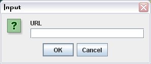
Figure 1 Streaming URL Dialog Box
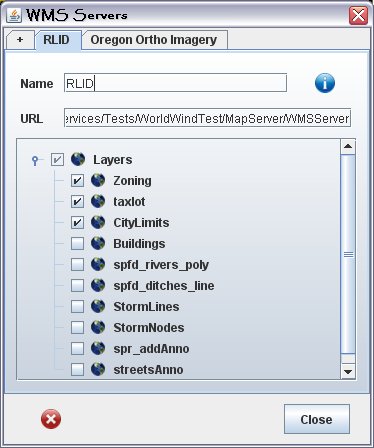
Figure 2 WMS Services Dialog Box accessing the Regional Land Information System.
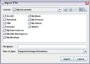
Figure 3 Imagery and Elevation file import Dialog Box.
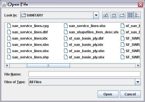
Figure 4 GIS and CAD Open File Dialog box.
Managing Content
Business Need: Simple and flexible methods to manage diverse forms of information within a single browser interface.
SDI-NoW Approach: Within two clicks of a mouse users can easily add static files, streaming files and web services to their 3D canvas and begin work. Once a layer is added, a robust layer manager dialog box provides control over layer state (active and available) and the order in which layers are displayed. This simple interface supports a broad array of local needs to mash-up and collaborate with facilities information, land information and local project data.
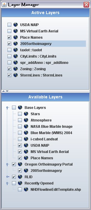
Figure 5 Layer Manager Dialog box.
Managing a 3D Environment
Business Need: Large-scale mapping requires spatial information and functionality designed to serve large-scale mapping analysis. Although state and national feeds of imagery and elevation information support many city-wide applications, local representation of this information support a variety of large scale engineering applications such as the vertical alignment of local streets and cross sections of local waterways.
SDI-Now Approach: Support precise local data with intuitive tools to navigate 3D models, visualize and inspect drainage characteristics, capacity, 3D distances, 3D volumes, slope and aspect on smaller sites.
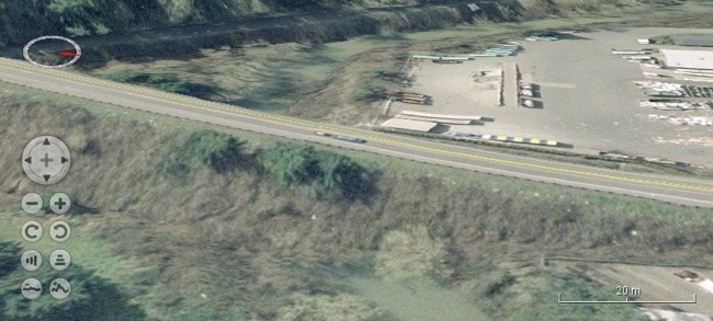
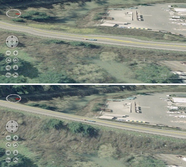
Figure 7 Mapping Street facilities with Local LiDAR (QL 1, 8pts per meter).
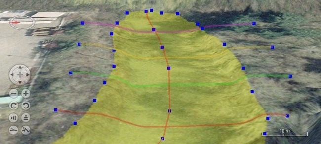
Figure 8 X-sections generated with 3D draw tools.
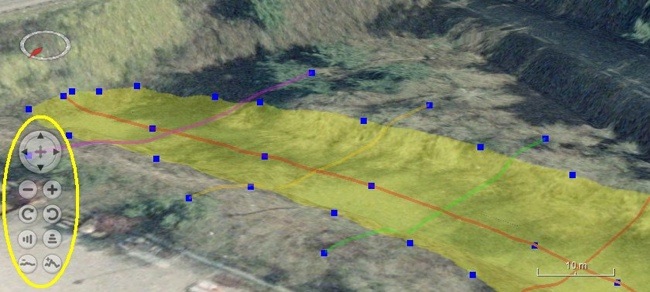
Figure 9 Navigation tools (circled in yellow) support zoom, pan, tilt and vertical exaggeration while editing.
