![]()
Many people have talked about a gap between surveying technology and geographic information system (GIS) technology over the years. Recent reports of precision farming uptake indicate lower than expected results – all at a time when commodity prices are high and food production is high on the agenda. What are the reasons for these lower uptake rates in the face of positive farm gate revenue in many places, and a future that looks even brighter for food producers, particularly those interested in maximizing production through geospatial and geomatics technologies?
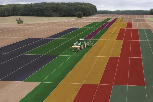 Image: ESALast week I published an entry indicating that the United States Department of Agriculture (USDA) had indicated lower than expected rates of Precision Farming uptake.
Similar reports have been available from Australia where the Western Grains Research and Development Corporation (GRDC) indicated similar responses. And, farmers perspectives on precision farming from Australia, have also been reported recently.
I’ve spent a few dozen years in agricultural research and have used these technologies in farm operations. The results from the USDA caused me to wonder and explore what is going on and why those results are appearing.
Here are some points for consideration:
In most cases GNSS technologies are used to navigate fields and to produce yield maps from fields. But they do not appear to extend into farm-scale operations, particularly over time. On the other hand, GIS technologies are used to map agricultural production and in many cases do not extend to any depth in terms of analysis or modeling.
I think precision farming needs to up-the-game. I wonder if it is reaching the benefits it can truly provide. More needs to be done.
1) We need survey related technologies like GNSS to talk about navigation and position relative to supporting the remote sensing and GIS functions of the operation more. We know sprayers and fertilizer applications are part of the picture, but we need to reach higher and push that knowledge into more integrated food production.
2) GIS needs to move beyond the map alone. We know where yields are high in fields, soil fertility etc., but we need to dive into landscape water management in 3D and it’s processes, think about space and time and the rapid introduction of imagery.
3) How much collaboration extends beyond the gate, supported with spatial data? The food production system extends to transportation, financial systems, local-regional climate in real-time – and food quality – not just amount.
4) What operational models can be used to purchase/share GNSS devices and GIS expertise? How can agronomic support link to knowledge transfer in a collaborative – and digital fashion? I’m not convinced every farmer needs to know GNSS, GIS or remote sensing – but systems to apply knowledge transfer based on these technologies seem waning.
So does a gap exist, and is precision farming suffering for it? I think so. Both surveying and GIS technologies can and should be doing more.
Perhaps we need to start asking, what is the best route forward to increase the production of high quality food into the future? Geospatial and geomatics technologies have a key role.
Why not set a goal of 25% more food produced by 2025?
