Tuesday, May 28th, 2013
In my work supporting disaster response operations, I have often heard practitioners say, “Where can we quickly get detailed and up-to-date map from?” Chris Hepp, by profession a medical doctor, faced the same issue when deployed on humanitarian and peacekeeping missions with international organizations to Albania, the Kosovo, Rwanda and Haiti. He recognized the value

Monday, May 6th, 2013
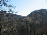
Every year, several hundred million hectares of forest, grasslands, and other types of vegetation burn throughout the world, and this amount is set to increase due to climate change. Wildfires pose a challenge for ecosystem management because they can be both harmful—threatening human life, property, economic activity and contributing to climate change—and beneficial—by regulating plant

Sunday, April 21st, 2013
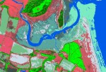
Organizations responsible for environmental monitoring, especially when it comes to ‘smart development’ in environmentally sensitive areas, are increasingly using the right geospatial data, tools and processes to ensure minimal impact.

Monday, April 15th, 2013
One of the key design constraints in the deployment of a sensor network is the optimization of power consumption and energy efficiency. A problem familiar to those working with embedded devices is the need to eke out every possible capability while working within a set of hard and fast constraints.

Tuesday, March 5th, 2013
The sciences, technologies, and practices of remote sensing and of geographic information systems (GIS) arose separately, developed in parallel, intersected, and are now inextricably linked. Nearly all the features in most GIS are collected by means of satellite imagery or aerial photogrammetry, and GIS is the application where this imagery is most commonly visualized. “All
Tuesday, February 26th, 2013
Good management decisions require the availability of quality information. For forest resource managers, the combination of airborne Light Detection And Ranging (lidar) remote sensing data together with Esri’s ArcGIS and the Forest Service, U.S. Department of Agriculture’s own FUSION software have created a powerful 3D environment capable of modeling a forest’s canopy structure.

Monday, January 21st, 2013
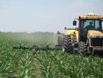
If Old McDonald had a farm today, he could manage it from his laptop computer and map it with an application on his handheld device. When he was out in the field, his tractor’s guidance system could know its position to within less than an inch, turning his planters and sprayers on and off accordingly.

Tuesday, January 8th, 2013
For the past decade – especially in the wake of the devastating 9/11 attacks – the provision of real-time, actionable intelligence to the security services and to the warfighter has been a major goal for the intelligence community. The proliferation of geospatial data – whether from UAVs, LiDAR, remote sensing or commercial satellite imagery –

Thursday, December 6th, 2012
Good data, more data, more accurate data; these are not sufficient to solve our world’s social and environmental problems. With these data, we can map the polygons of poverty like we map political preferences or climate change, but they are not sufficient to explain the social mechanisms that create and maintain poverty. Without understanding and

Thursday, December 6th, 2012
“So, what do you do?”—it’s the dreaded question whenever I meet someone new. Dreaded because I can’t really sum up what I do to myself, let alone to someone else. How I answer often depends on my level of investment with the person.