Tuesday, February 28th, 2023
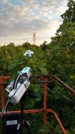
In a new study, University of Missouri researcher Jeffrey Wood introduces the “ecosystem wilting point” concept, which explains how whole forests respond to drought. Wood and his research team found that when forests reach their ecosystem wilting point, they are less able to function properly, which includes their ability to absorb carbon dioxide. To learn
Saturday, February 11th, 2023
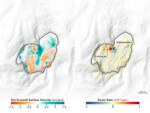
A team of international researchers, including one from NASA’s Jet Propulsion Laboratory, has combined satellite and archival imagery to show how one African city’s changing water usage influences land movements near and just below the surface. The new study zeroed in on Bukavu, a hillslope city in the Democratic Republic of the Congo. The researchers

Monday, January 30th, 2023
As of 2022, Brazil’s Munduruku Indigenous Reserve is the second worst-affected territory occupied by illegal miners in the country. In 2021, the illegal mining there grew by 363 percent within only two years, seizing hundreds and hundreds of lands. The situation with the Munduruku people is only one possible focal point to evaluate the scale
Tuesday, January 17th, 2023
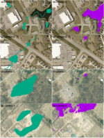
Chesapeake Conservancy’s data science team developed an artificial intelligence deep learning model for mapping wetlands, which resulted in 94% accuracy. Supported by EPRI, an independent, non-profit energy research and development institute; Lincoln Electric System; and the Grayce B. Kerr Fund, Inc., this method for wetland mapping could deliver important outcomes for protecting and conserving wetlands.
Monday, December 5th, 2022
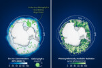
A decade ago, scientists on a NASA-sponsored ocean expedition found massive populations of phytoplankton blooming beneath sea ice in the Arctic Ocean. Now scientists using underwater instruments and a NASA satellite have found evidence of potentially significant blooms beneath the sea ice encircling Antarctica. The findings were recently published in the scientific journal Frontiers. Phytoplankton
Monday, November 21st, 2022
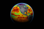
By 2050, sea level along contiguous U.S. coastlines could rise as much as 12 inches (30 centimeters) above today’s waterline, according to researchers who analyzed nearly three decades of satellite observations. The results from the NASA Sea Level Change Team could help refine near-term projections for coastal communities that are bracing for increases in both

Friday, November 4th, 2022
GeoSLAMs LiDAR technology is mapping forests as part of the Centre for Research-based Innovation (SFI) SmartForest in Ås, Norway. SFI SmartForest aspires to put the Norwegian forestry sector at the forefront of technological advances and Industry 4.0. Led by The Norwegian Institute of Bioeconomy Research (NIBIO), the SFI SmartForest aims to bring industry 4.0 to

Tuesday, October 25th, 2022
Ship tracks, the polluted marine clouds that trail ocean-crossing vessels, are a signature of modern trade. Like ghostly fingerprints, they trace shipping lanes around the globe, from the North Pacific to the Mediterranean Sea. But in 2020, satellite observations showed fewer of those pollution fingerprints. Drawing on nearly two decades of satellite imagery, researchers found
Monday, October 10th, 2022
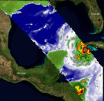
Two recently launched instruments designed and built at NASA’s Jet Propulsion Laboratory in Southern California to provide forecasters data on weather over the open ocean captured images of Hurricane Ian on Sept. 27, 2022, as the storm approached Cuba on its way north toward the U.S. mainland. COWVR (Compact Ocean Wind Vector Radiometer) and TEMPEST

Friday, September 23rd, 2022
If global warming persists, blue lakes worldwide are at risk of turning green-brown, according to a new study which presents the first global inventory of lake color. Shifts in lake water color can indicate a loss of ecosystem health. While substances such as algae and sediments can affect the color of lakes, the new study
There are no upcoming events.
