 For the past 20 years, numerous enterprising primary and secondary educators have used GIS to engage their students in real-world investigations from local to global scale. GIS in education has recently received a tremendous boost through Esri’s participation in the White House’s ConnectEd initiative. Through the initiative, designed to strengthen Science, Technology, Engineering, and Mathematics (STEM) education, Esri is offering an ArcGIS Online organizational subscription to any of the more than 100,000 K-12 public, private, or home schools in the USA.
 Esri, through the ConnectEd program, provides ArcGIS Online technology to help teachers and students explore their community and their world.Using GIS provides a way of exploring a rich body of content, a framework for thinking about the world, and key critical and holistic thinking skills. Moreover, it offers career pathways that are increasingly in demand according to the U.S. Department of Labor (Gewin 2004). GIS provides a problem-solving, standards-based skill set. Through GIS, students grapple with current, relevant, important issues in science, such as sustainable agriculture, natural hazards, water, energy and climate change. Spatial analysis through geotechnologies helps students solve problems. Students see the big picture so that they can understand how different patterns and trends are related. Students become involved digital citizens that can use the technologies to ask the “what if” questions, test hypotheses, and model scenarios using a valuable 21st century tool.
Spatially based questions begin with questions. Why are cities located where they are, and how are they affected by their proximity to nearby things and by global interconnections? What is the relationship between birth rate and life expectancy? How does acid mine drainage in a mountain range affect water quality downstream? How could climate change affect global food production? Giving students a reason to learn is powerful. Studying issues with GIS lends relevancy and real-world contexts and appeals to today’s visual learners. Students who use GIS in tandem with their studies develop key critical thinking skills. These skills include understanding how to carefully evaluate and use data. This is especially critical in assessing earth-related data, due to its volume, diversity, and often sensitive nature.
Students who are well grounded in the spatial perspective through GIS are better able to, upon graduation, use data at a variety of scales, in a variety of contexts, think systematically and holistically, and use quantitative and qualitative approaches to solve problems. In short, these graduates are better decision-makers. Students engaged in GIS make frequent use of the geographic inquiry process, which involves asking geographic questions, acquiring geographic information, exploring geographic data, analyzing geographic data, and making decisions—acting on that information. This often leads to additional geographic questions, and the cycle continues.
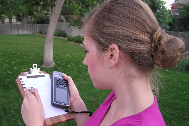
 Students who collect data in the field can map and analyze it using ArcGIS Online.ArcGIS Online can be used on a wide variety of tablets, laptops, operating systems, and browsers, making it easier for a school’s IT staff than desktop software. Students can also use ArcGIS Online’s mobile capabilities to collect data in the field, important where outdoor education is often cut due to budgetary constraints, and when many have almost no connection with the outdoors (Louv 2006). In the field, students gain additional insight about processes, scale and the environment. They can sketch, record video, take photographs, or simply use their senses. They can collaboratively collect data as citizen scientists using an ordinary smartphone and have results appear automatically on a web-based GIS map using the Collector for ArcGIS app.
No technology, however compelling, is guaranteed to be used without the proper support. For GIS to be adopted by the majority of schools will take a team effort from educators, citizens, policymakers, and GIS professionals. The Esri ConnectEd site contains activities and lessons to enable educators and their students to start with spatial analysis, and the Esri Education Community connects educators to resources that enable the effective use of GIS in education. GIS professionals can help by working with schools through the GeoMentor program. Professional development opportunities such as the Teachers Teaching Teachers (T3G) event and online courses on spatial analysis such as those offered for educators by Esri, and those offered by the Online Learning Consortium and eNet Learning need to be publicized and expanded. Policymakers and administrators need to be shown the value that spatial analysis brings and how it is connected to their curriculum and their state and national content standards.
See this article for more information about the Esri ConnectEd initiative.
Resources