
Monday, December 18th, 2017
Along with the larger forces of climate change, another contributing factor to the fierce wildfires in California has been the dry soil conditions. Light rainfall, combined with heavy use of aquifers by large farms, has created perfect conditions for an inferno. Stories of homeowners saving their homes by turning on sprinklers remotely are not as

Monday, November 20th, 2017
Legislative sponsors Senator Orrin Hatch (R-UT) and Senator Mark Warner (D-VA), U.S. Representative Bruce Westerman (R-AR-04), and U.S. Representative Seth Moulton (D-MA-06) collaborated with GIS organizations across government and industry to advocate for common data standards, interagency collaboration and transparency to taxpayers on shared national data services. Agreeing to a common vision will make it

Monday, November 13th, 2017
Boeing completed the acquisition of Aurora Flight Sciences Corp., which will operate under Boeing Engineering, Test & Technology as a subsidiary called Aurora Flight Sciences, A Boeing Company. It will retain an independent operating model. Headquartered in Manassas, Va., Aurora has more than 550 employees and operates in six locations, including research and development centers

Tuesday, October 31st, 2017
The European Space Agency (ESA) and Radiant.Earth will jointly enhance geospatial data literacy in the global development community to help track the Sustainable Development Goals (SDGs). “Geospatial information is central to accurately tracking and measuring the global progress of the SDGs,” noted Radiant.Earth Founder and CEO Anne Hale Miglarese. The ESA and Radiant.Earth cooperation focuses

Tuesday, October 17th, 2017
In support of CAL FIRE’s firefighting efforts in Northern California, the California Air National Guard’s 163d Attack Wing operating out of March Air Reserve Base is using MQ-9 Unmanned Aircraft Systems (UASs) with full-motion video (optical and infrared) and ground imaging Synthetic Aperture Radar (SAR) capability, which can see through clouds and smoke. “The 163d
Monday, September 25th, 2017
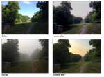
Forest fires in Southeast Asia during the El Niño droughts of 2015 caused considerable disruption to the biodiversity of the region due to the smoke-induced haze they created, according to new research published in the Environmental Research Letters journal and led by Benjamin Lee at the University of Kent and the National Parks Board in
Monday, September 18th, 2017
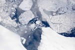
Operation IceBridge is flying in Greenland to measure how much ice has melted during the summer. The flights, which began on Aug. 25, 2017, and will go on until Sept. 21, 2017, repeat paths flown this spring and aim to monitor seasonal changes in the elevation of the ice sheet. “We started to mount these
Monday, September 11th, 2017
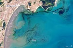
In early September 2017, ocean scientists noticed something swirling in the waters off the coast of the Brazilian state of São Paulo. The sinuous threads of darkness amid the blue Atlantic Ocean were not caused by oil; they were the result of a phytoplankton bloom. The dark colors are probably high concentrations of dinoflagellates, according
Tuesday, August 1st, 2017
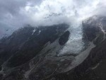
According to a new study published by USC scientists in the Proceedings of the National Academy of Science, rock and soil breakdown in glaciers generates more acidity and releases more carbon than other forms of natural weathering. Perhaps most interestingly, it is the elevated oxidation of pyrite, popularly known as “fool’s gold,” in the glacial
Tuesday, July 25th, 2017
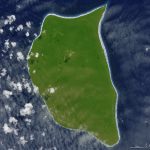
In the middle of the South Pacific Ocean, far from the urban, developed world, there’s a small, lush, green island with white sand beaches. However, this uninhabited, remote corner of the tropics—Henderson Island—also has a trash problem. The beaches of Henderson Island have the highest density of plastic waste in the world, according to a
There are no upcoming events.
