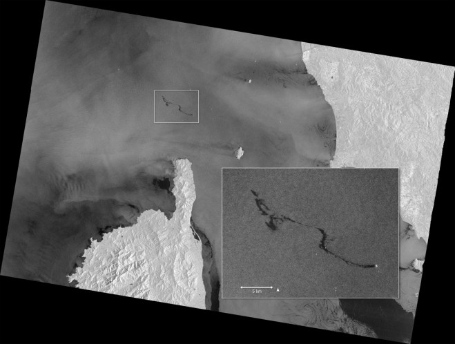

The Copernicus Sentinel-1 mission imaged the oil spill in the Mediterranean following a collision between two merchant ships on Oct. 7, 2018. Other dark areas show patterns featuring low reflectivity of the radar signal, such as very calm waters. (Contains modified Copernicus Sentinel data (2018), processed by ESA)
On Oct. 7, 2018, a Tunisian cargo ship is reported to have struck the hull of a Cypriot container ship in waters north of the French island of Corsica. There were no casualties, but the collision caused a fuel leak that resulted in an oil slick about 20 kilometers long. Although the collision occurred in French waters, the cleanup operation is part of a joint pact between France, Italy and Monaco to address pollution accidents in the Mediterranean.
This image of the slick, which can be seen as a dark patch north of the tip of Corsica, was captured by the Sentinel-1A satellite built for the European Commission’s Copernicus environmental monitoring program.