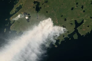
An astronaut aboard the International Space Station photographed wildfire smoke from Nova Scotia billowing over the Atlantic Ocean in May 2023. Warm weather and lack of rain fueled blazes across Canada last year, burning 5 percent of the country’s forests. (Image Credit: NASA)
Stoked by Canada’s warmest and driest conditions in decades, extreme forest fires in 2023 released about 640 million metric tons of carbon, NASA scientists have found. That’s comparable in magnitude to the annual fossil fuel emissions of a large industrialized nation. NASA funded the study as part of its ongoing mission to understand our changing planet.
The research team used satellite observations and advanced computing to quantify the carbon emissions of the fires, which burned an area roughly the size of North Dakota from May to September 2023. The new study, published on Aug. 28, 2024, in the journal Nature, was led by scientists at NASA’s Jet Propulsion Laboratory in Southern California.
