 A key component in the global effort to mitigate climate change is to measure and map the amount of carbon stored in forests. This is at the core of the United Nations Collaborative Programme on Reducing Emissions from Deforestation and Forest Degradation in Developing Countries (REDD) and of similar “cap & trade” initiatives in developed countries. The most accurate and cost-effective method to measure forest carbon combines remote sensing — specifically, satellite imagery and aerial LiDAR — and field measurements.
Carbon dioxide (CO2) is the most important anthropogenic greenhouse gas. As forests grow, they absorb CO2 from the atmosphere, in a process called sequestration, while deforestation and forest degradation release it back into the atmosphere. Therefore, the amount of carbon stored in forests is of great scientific, economic, and political interest.
The effects of deforestation are often dramatic. Forest carbon stores can drop from 300 tons per hectare to 20 tons per hectare, says Alessandro Baccini, an assistant scientist at the Woods Hole Research Center. Deforestation in the tropics alone is equal to all of the transportation sources of carbon dioxide globally combined, according to Greg Asner, a staff scientist in the Department of Global Ecology at the Carnegie Institution for Science. Conversely, “if forests are managed productively and not converted to other uses, if the wood is utilized in long term products and for energy in a substitution benefit, one can use forests to take some carbon out of the atmosphere,” says Jeremy Fried, Research Forester at the U.S. Forest Service Pacific Northwest Research Station in Portland, Oregon.
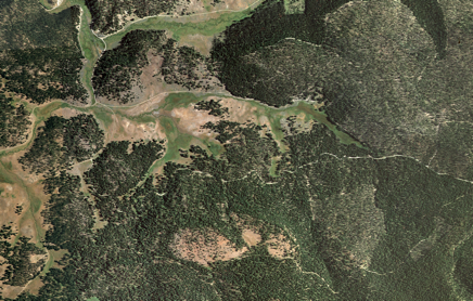
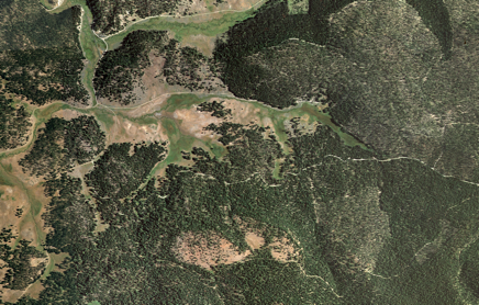
This aerial photograph from the Malheur National Forest shows meadows and forest land
with evident past management activities. Source: US Forest Service
Therefore, a key component in the global effort to mitigate climate change is to measure and map the amount of carbon stored in forests. This is at the core of the United Nations Collaborative Programme on Reducing Emissions from Deforestation and Forest Degradation in Developing Countries (REDD) and of similar “cap & trade” initiatives in developed countries. The most accurate and cost-effective method to measure forest carbon combines remote sensing — specifically, satellite imagery and aerial LiDAR — and field measurements.
By contrast to the large and rapid changes in forest carbon content due to deforestation and degradation, the increases in carbon sequestration due to natural forest growth are very small, as are the differences in carbon content between forest tracts due to different forest management practices. The small size of these changes, combined with the many sources of measurement error and uncertainty, makes it very tough to measure them accurately.
Fried and other researchers for the Forest Service’s Forest Inventory and Analysis (FIA) program use a combination of systematic and randomized sampling to select locations to install plots in federal forests to generate data for analysis. In each plot, they then measure the circumference of every tree that is 5 inches or greater in diameter. To get height, they use a laser range finder and an angle gauge, from a distance. They also account for every tree, note their species, and measure dead, down wood on the ground and assess its degree of decay. Researchers have to choose among many available volume and biomass equations for each tree’s trunk, and then repeat the process for its bark, branches, and roots.
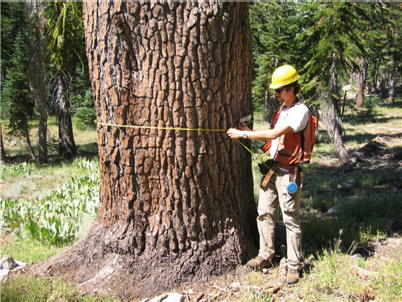 Ground measurements of tree circumferances are one accurate
measurement to generate data for analysis.
“The structure of the forest is pretty complex and very different from one place to another,” says Dr. Demetrios Gatziolis, a colleague of Fried in the Portland office. Therefore, he explains, to be accurate, estimates must be based on localized equations. Developing them, however, requires “a significant effort of destructive sampling in many places and for all species.”
“The biomass itself is going to vary depending on whether the wood is dead, how long it has been subject to decay and, if it is live, whether it has cavities, defects, or rot — there are many fudge factors,” says Gatziolis. “So, even if you could accurately measure the volume, that would only get you part way.”
The denser the forest, the harder it is to use remote sensing effectively, says Bill Stewart, a cooperative extension specialist at the University of California – Berkeley. “When you are trying to do remote sensing from the air, when you basically are looking at a canopy, whether it has 200 tons of carbon per acre or 400 tons per acre, it has a very similar signature. So, at lower densities, especially if the trees are spread apart, they are getting really good estimates, but it starts to fall apart at the really high densities.”
“The trunks may be 20 percent to 50 percent of the carbon on the site. Then there are the branches and the bark and the roots and the understory vegetation and the down wood and the soil carbon ,” says Fried. “It’s a lot of pools that we don’t measure, that are affected by what you do in the stand.”
The soil carbon alone can account for up to half of all the carbon on a site, says Dr. Andrew Gray, another colleague of Fried in the Portland office. “We don’t have really hard numbers on it. Anything below ground is always ten times more difficult to get a good answer around than anything else we have.”
The carbon content of wood varies from 47 to 53 percent of its biomass, depending on climate, species, stand history, and other factors. To estimate biomass in the field, researchers can either measure the diameter, height, and density of trees in an area and then use equations to convert these measurements to estimates of above-ground biomass, or they can cut trees down, dry them, and weigh them. The latter method also helps refine the equations used in the former. The Carnegie Institution has done extensive work on both methods. For mathematical reasons, the errors inherent in converting field measurements to biomass estimates diminish when averaging them out over the large areas that would be involved in carbon trading, Asner explains. However, he points out, the number one source of error and uncertainty are field plots, “How the heck do you put out enough field plots to represent the environmental heterogeneity that is found in forests?”
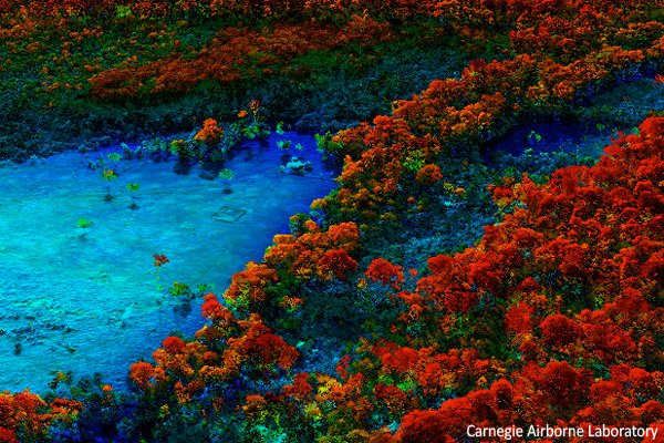
The aerial platform of the Carnegie Airborne Laboratory collects a detailed picture of the forest.
For these reasons, Asner argues, it is critical to rely on remote sensing. “The remote sensing method, especially the airborne LiDAR approaches that we’ve led, are extremely accurate at extending these field plots out to areas that are much more representative of the environmental variation that is out there. We’ve made huge progress on how to do it and the errors that we’re getting from airborne LiDAR are down in the 10 percent uncertainty range. We’ve proven that over and over again, in heavily peer-reviewed literature, from Madagascar to Amazonia to Central America to even Hawaii. It’s gotten to be so scientifically routine that I’m moving on to other stuff.”
Baccini points out two additional reasons for using remote sensing. First, field plots are very unlikely to be located where degradation is occurring. “Forest inventories are good in detecting changes in field plots. But if the changes are outside the field plots, you are going to miss them.” Second, remote sensing allows researchers to access regions that it has never been possible to measure on the ground. “For example, in Africa, there are places where, due to war, political instability, and so on, it would be impossible to conduct a field sample.” While he concedes that the measurement error with LiDAR may be higher than that from field measurements, he argues that the large sample size more than compensates for this.
Overall, remote sensing is helping to reduce the uncertainties, Baccini says, and he points out that all three of the methodologies endorsed by the IPCC include a large component of remote sensing and mapping. Where it is not possible to take field measurements to calibrate the LiDAR, researchers find another area that has the same LiDAR signature and collect the field data there, then extrapolate their estimates.
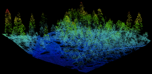
Elevation-colored, high-density LiDAR point cloud. Source: US Forest Service
According to Baccini, carbon mapping does not require prior land cover classification. “We are now able to map biomass directly,” he says. “It does not matter whether you know what is and what is not forest. From the field measurement, we estimate how much carbon stock is on the ground and then we use this information to calibrate models that, as a function of the satellite data, are telling us what the amount of carbon stock is in places where we don’t have field observations.”
In 2006, the Intergovernmental Panel on Climate Change (IPCC) released a set of guidelines for the international community on carbon trading and carbon monitoring. “There are probably thousands of pages of documentation, discussed, negotiated, and agreed upon by all the nations involved in the United Nations Framework Convention on Climate Change (UNFCCC),” Asner explains. “Those agreements state that carbon can be monitored at different levels of precision and accuracy and that, depending on the level of reporting, there will be a discount rate applied to the carbon credits. Yet those agreements still can move forward as an instrument for climate change mitigation. This process has been in place for nearly a decade now and is quite mature.”
While international negotiations are understandably moving slowly because they involve more than 130 countries, they are moving forward rapidly between states under the Governors’ Climate and Forests Task Force (GCF). At the forefront of the GCF, which links states around the planet, are California, Chiapas, in Mexico, and Acre, in Brazil. “It is getting money flowing to these countries for reducing their carbon emissions from deforestation and forest degradation,” says Asner, who is on the GCF’s technical advisory committee, “and it is a way to provide carbon offsets for emitters in California. To me, that’s where the action is. None of those agreements would be going forward if the errors in the reporting on the MRV [measurement, reporting, and verification] side were going to be too large for the policy instruments to be able to handle.”
“Because of rapid changes in technology, people can keep creating new maps, but it’s sometimes not that easy to check which one’s actually a better estimate,” says Stewart. Maps of carbon densities produced by the U.S. Environmental Protection Agency “look like they have wall-to-wall coverage of the United States,” he points out. “But to know how accurate that is you need to really know how the forest is actually changing.” Instead of just making “another pretty new map,” he argues, we need to try to better understand the process.