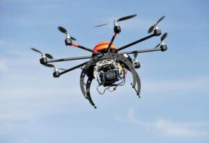
 With applications ranging from agriculture to urban planning, the global aerial imaging market is poised for exponential growth. Experts predict that by 2032, the market size is set to surpass a staggering $25 billion.
Expanding Applications
Aerial imaging is finding applications in a diverse range of sectors. In agriculture, it aids in precision farming by providing farmers with vital insights into crop health, enabling more efficient resource allocation. In urban planning and infrastructure development, it offers detailed 3D models and maps, aiding in design, monitoring and maintenance. Furthermore, industries like real estate, environmental monitoring and disaster management have also been quick to adopt this technology.
Technological Advancements Driving Growth
The rapid evolution of imaging technologies has been a major catalyst for the aerial imaging market’s growth. High-resolution cameras, and advanced image-processing algorithms are now capable of capturing incredibly detailed and accurate data. This has unlocked new possibilities for applications such as forestry management, geological surveys, and wildlife conservation.
Cost-Efficiency and Time Savings
Aerial imaging significantly reduces the time and resources required for data collection compared to traditional ground-based methods. Drones, in particular, have become indispensable tools for industries seeking to gather precise information in a cost-effective manner. This has made aerial imaging an attractive option for businesses looking to enhance their operational efficiency.
Regulatory Frameworks and Compliance
The aerial imaging industry is subject to evolving regulatory frameworks. Governments around the world are recognizing the potential of this technology while also implementing measures to ensure safety, privacy, and data protection. Industry players are working closely with regulatory bodies to establish guidelines that strike a balance between innovation and responsible use.
Emerging Markets and Untapped Potential
While developed regions have been at the forefront of adopting aerial imaging, emerging markets are now catching up. Countries in Asia, Latin America, and Africa are increasingly recognizing the benefits of aerial imaging across various sectors. This presents a significant growth opportunity for companies in the industry.
Challenges and Future Prospects
Despite its tremendous potential, the aerial imaging market faces challenges such as limited access to airspace, weather-related constraints, and data processing complexities. However, continuous research and development efforts are focused on overcoming these hurdles. Advancements in AI-powered data analysis and automation are expected to further streamline workflows.
Source: https://www.gminsights.com/industry-analysis/aerial-imaging-market
