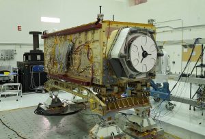
OCO-3 sits on a large vibration table in the Environmental Test Lab at the Jet Propulsion Laboratory. (Credit: NASA/JPL-Caltech)
When the Orbiting Carbon Observatory 3 (OCO-3) heads to the International Space Station, it will bring a new view to studies of Earth’s carbon cycle. From its perch on the space station, OCO-3 will observe near-global measurements of carbon dioxide on land and sea, from just after sunrise to just before sunset. That makes it far more versatile and powerful than its predecessor, OCO-2.
“OCO-2 revisits areas on Earth at roughly the same time of day due to its sun-synchronous orbit,” said Matt Bennett, OCO-3’s project systems engineer at NASA’s Jet Propulsion Laboratory in Pasadena, Calif. “OCO-3 will expand the time period of that coverage and observe the presence of carbon dioxide at varying times of day.”
Since the space station orbits Earth every 90 minutes, OCO-3 will complete 16 passes a day. The OCO-3 space instrument is the immediate successor to OCO-2, which has been studying carbon dioxide distribution, and detecting emission hotspots and volcanoes since 2014.
OCO-3’s new capabilities depend heavily on an innovative swiveling mirror assembly, which Bennett described as a “very agile pointing mechanism.” The pointing assembly uses two pairs of mirrors to rotate in two complementary directions—one parallel to Earth’s surface, the other perpendicular. This setup allows OCO-3 to point to just about anywhere within view of the space station but also allows it to capture detailed mini-maps of carbon dioxide over areas of interest.
This snapshot mapping mode can measure emissions from sources ranging from relatively small areas surrounding power plants to large urban areas up 1,000 square miles (2,590 square kilometers) in just two minutes. That means OCO-3 can measure the entire Los Angeles Basin in just a single pass—a task that would take OCO-2 several days. Measuring large urban areas is particularly important to scientists since about 70 percent of total fossil-fuel emissions come from large cities.
