![]() Planning and mainly spatial planning deals with the spatial dimension of development. It is concerned not only with architecture but also with the place where people live and work. Spatial planning is one of the major challenges facing Europe. In the future it won’t be possible to solve planning problems of regional development without access to spatial knowledge. Good knowledge of environmental, economic and social aspects of sustainability is necessary. Spatial planning is the key issue for the territorial development in all the partners’ countries and in principle in all Europe.
Planning and mainly spatial planning deals with the spatial dimension of development. It is concerned not only with architecture but also with the place where people live and work. Spatial planning is one of the major challenges facing Europe. In the future it won’t be possible to solve planning problems of regional development without access to spatial knowledge. Good knowledge of environmental, economic and social aspects of sustainability is necessary. Spatial planning is the key issue for the territorial development in all the partners’ countries and in principle in all Europe.
Introduction
In 2007 the European directive INSPIRE was approved. This directive affects also spatial planning. The spatial planners (architects and public servants) from the partner’s countries have difficulties to adopt the INSPIRE directive into their work. The problem of sustainability planning is now a challenge for all levels of
society including stakeholders and policy makers. The importance and the interest in Spatial Data Infrastructure (SDI) are growing.
SDI is the base collection of technologies, data, human resources, policies, institutional arrangements, and partnerships that enable the availability, exchange of, and access to geographically related information using common practices, protocols, and specifications. The concept of SDI resides in working smarter not harder by re-using data, technical capabilities, skills, intellectual effort and capital through sharing the costs of people, technology and infrastructure. Spatial Data Infrastructures rely on the development of policies, technologies, data, common standards, standard practices, protocols and specifications.
The SDI main concept is to move spatial data into Web environment and to use Web services for building network of distributed geoportals. Using of the new methods of digital cartography enables us to go beyond linguistic frontiers. The European INSPIRE Directive defines the standards for future European SDI. With implementation of the INSPIRE Directive there will be a strong need for capacity building and transfer of experience among architects, spatial planners, European Regions and municipalities. Nevertheless, there is no platform where it is possible to educate planners about problems of SDI in different regions in more detail. Also there is no platform where it is possible for people to publish their information about the current situation, share their knowledge with other groups, and also share this knowledge with the scientific community.
Due to the INSPIRE Directive and its implementation each Member State has to transpose the INSPIRE Directive into its national legislation and to develop the interoperable services allowing the management and sharing of spatial data. There will be also requirements on spatial planning to accept the implementation rules of INSPIRE Directive. The SDI-EDU project is going to support training of responsible people to set up and use some of these services according to the specific problems of the EU regions on local and regional level. Thus the project will let the regions participate actively in the implementation of the INSPIRE Directive.
European Project SDI-EDU
The full name of the project is ‘SDI-EDU for regional and urban planning’ (with the acronym SDI-EDU). The SDI-EDU project belongs to the framework of the Leonardo da Vinci Lifelong Learning Programme. In particular it is a multilateral project – transfer of innovations. The knowledge stated in the created educational content is transferred mainly from the projects Plan4all, Humboldt and Naturnet Redime. The SDI-EDU project started on October 1st, 2009 and its duration is 24 months. The keywords for the presented project are ‘SDI’ as Spatial Data Infrastructure and ‘EDU’ as Education. One of the main aims of the project is to establish a geoportal which will serve for vocational education of spatial planners. The spatial planners could find here information, educational material and documents which will provide them with the knowledge about the INSPIRE related topics which will influence their daily work in very close future.
SDI-EDU Educational Content
The educational content covers the basics and the most important topics related to the INSPIRE Directive and also reflects the hot-topic specifics. Based on the user requirements which were collected at the beginning of the project the core lessons are for example about a spatial data harmonization process. The content was translated into all partner languages (Bulgarian, Czech, Greek, Italian, Latvia, Lithuanian and English). It contains also partial chapters unique in given country. These specifics could be seen as marginal in the European context, but they are important for the final success of educational process: the more the content reflects a local situation, the more the audience will understand the higher level scale
planning problems. Internationalization of this specific learning content caused improving the flexibility and competitiveness at the end.
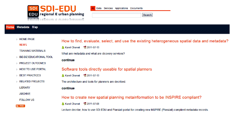 Figure 1: SDI-EDU educational geoportal – the main page
The drafted educational syllabuses were transformed and developed into practise-oriented teaching lessons using by all the SDI-EDU set of instruments. The teaching content was proved in partner countries on ordinary. Getting the feedback the syllabus was improved and modified to maximise the synergic effects and get the most efficient learning. Each particular lesson as one teaching unit should last between 30-60 minutes, should be consumable in both remote and in-class form. The system of lectures should allow skipping over what the student knows, or what he/she is not interested in. We build a system for spatial
planners, who are usually graduated experts, so these lectures must be flexible and usable for life-long and vocational learning too. The project team plans some feedback control of the original syllabus after practical teaching and testing.
Educational Geoportal
The SDI-EDU platform for vocational e-learning is designed and implemented as a virtual database based on social networks principles of the GeoPortal4everybody and principle of web services using Uniform Resource Manager. It integrates different technologies and methods like GIS, e-learning, multimedia, and virtual reality. Important part is integration of social media tools. These services are not implemented on SDI-EDU portal directly but they are implemented as virtual services on different places in Europe. The access is guaranteed through a single access point at http://portal.sdi-edu.zcu.cz. Single access point is based on GeoPortal4everybody bus component and SimpleCMS Social Network Content Manager.
As external applications could be used by different desktop GIS tools, main support in education will be for Janitor and Topol, but these tools are not direct part of solution, they are more related to educational content. The portal is implemented with initial menu and content, all could be later updated by project team. Selected part will be also possible modified by external users.
The last part of the SDI-EDU project’s educational platform is the BizBiz tool. BizBiz is a learning video tool for SDI-EDU training platform. It is integrated into URM portal. BizBiz is a web browser based e-conference collaboration and learning tool which allows conference members to watch live video enabled presentations remotely from their computers.
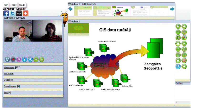 Figure 2: Using of BizBiz – a live lecture with feedback
It does not require users to install special software apart from modern web browser and java virtual environment and most of the configuration connected with webcam and screencast is done automatically. Additional equipment is headphones, optionally webcam. BizBiz focuses
on providing a learning platform for spatial planning and GIS but can be used also in other applications. BizBiz is free of charge and published under open source (Affero GPL) licence in source forge.The training process can be realized as:
Online video lecture is very effective method. But there is one shortcoming – there is fixed date and time when online video lecturing is being conducted. Therefore there may be situations when many potential audience members cannot participate. Recorded lectures enable watching the lecture in acceptable time for every interested person. Therefore recorded lectures also play important role in training.
Every lecture’s life cycle consists of several stages:
—————————————————————————–
Karel Janecka – University of West Bohemia, Pilsen, Czech Republic, [email protected]
Karel Charvat – Czech Centre for Science and Society, Prague, Czech Republic, [email protected]
