 This topic was addressed in a workshop called “Putting complexity to work – supporting the Practitioners” organised by The abaci Partnership on 24 September 2009 as part of the European Conference on Complex Systems (ECCS 2009) held at the University of Warwick, UK. The Workshop explored novel approaches for dealing with the complex spatial realities that practitioners face in their day-to-day work. It showed that insights from complexity science could assist people working in emergency relief, humanitarian aid, local and regional planning, sustainable development, climate change initiatives, health care, logistics planning and business strategy development, to name a few.
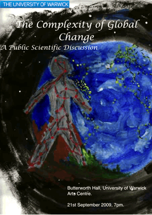
Complexity science is ideally suited to these tasks as it addresses the types of phenomena that arise from the dynamic, interconnected nature of the real world by providing approaches to understand and solve problems and take advantage of emerging opportunities. The relevance of the Workshop was highlighted by a public session of the ECCS 2009 which discussed ‘The Complexity of Global Change.’
The Expert Panel in that session expressed the realisation that complex (spatial) problems, such as climate change, cannot be adequately examined at present owing to both the lack of interconnected models at all scales and the incomplete understanding of the widely diverse nature of the variables involved. In addition, The Panel also highlighted the lack of appropriate data (as they are often inaccessible because they are hidden within the interactions between natural processes) and the inability to adequately model complex realities such as human behaviours. These limitations are not always fully acknowledged by scientists and decision-makers and the Panel noted that this would reduce the utility of the results for planning and policy-making.
 These issues raised during the public session serve as good examples of the types of practical challenges that the Workshop on 24 September addressed. The Workshop both developed ‘common ground’ between practitioners and complexity scientists to improve their understanding of complex and dynamic spatial realities and then indentified strategies and approaches for dealing with them.
By listening to and learning from practitioners’ experiences the participants were able to explore the issues that arise in complex realties and address how to deal with them to achieve sustainable solutions and introduce novel approaches by exploiting insights from complexity science. To this end, both complexity scientists and practitioners from various application fields and levels of planning and decision making attended the Workshop. The morning session was dedicated to capturing examples of the kind of situations in which practitioners work. Speakers from a wide range of application fields illustrated the variety of these complex (spatial) realities.
Robert Holloway, Director of the AFP Foundation in Paris, France set the scene. He described the Foundation’s work in training journalists in Developing Countries who are reporting facts from calamitous events (such as earthquakes or conflicts) and in culturally and politically sensitive settings. He provided particular examples from the Lebanon where extremely diverse viewpoints among inhabitants of the different quarters of Beirut had to be addressed. Eileen Conn from Living Systems Ltd, UK elaborated on the problems of ‘Community Engagement’, which is UK Government policy, where the Government assumes that communities will have an institutional structure with which it can interact on its own terms. Eileen highlighted that this was not the reality – community engagement cannot be imposed top-down and, in any case, communities do not have organisational structures of the type that governments expect for interaction. Eileen developed a ‘model’ for more effective engagement which both acknowledged and addressed these incompatibilities.
Anna Plodowski described the Peckham Power Project (UK) which exemplifies such a community engagement project in the London suburb of Peckham. The Project aims to introduce a renewable, energy-efficient infrastructure. Anna highlighted the range of social, organisational and technical difficulties experienced and the approaches taken to deal with them. Group work then followed which captured each participants own experience and built them into a systematic understanding of the issues at stake.
These included that: Mechanistic, reductionist, ‘mono-disciplinary’ approaches are often used which do not address the complexity of real-world situations; Complexity is perceived as ‘difficult’ regardless of whether it actually was; There was commonly a lack of recognition and / or perception that a problem or situation was complex and that a different approach was therefore required; People found it difficult to comprehend the nature of the complexity they were facing; There was little appreciation of the need to include, understand and reconcile the viewpoints of various stakeholders; The limited capability of models to deal with complex realities was not fully appreciated;
There was a fundamental lack of interoperability between data, mindsets and organisations – especially when dealing with dissimilar scales and time-horizons; The ‘right’ data was often unavailable – even uncollectable; Top-down approaches were often seen as the only and exclusive way to deal with real-world problems.
The afternoon session moved on to identify how these issues, practically, could be addressed. The speakers indicated both a range of suitable options which had been informed by insights from complexity science and some strategies for employing them. Dave Palmer (Phrazzle Associates, UK) highlighted the challenges from the business world’s perspective and provided a systematic analysis of the options for addressing them, showing where insights from complexity science might prove relevant. Dr. Erik de Man (formerly ITC, The Netherlands) introduced the concept of Transdisciplinarity as a way for people with various mindsets to work together to grasp complex problems.
His talk developed the concept of Transdisciplinarity from dealing with ‘information about space’ and Geographic Information Science to handling complex problems in general. Dr. de Man specifically highlighted the fact that solutions to complex problems are not, in most cases, of a technical nature; rather that most need to be tackled in the social domain through human relationships and interactions.
He also made clear that complexity is not a problem per se – it is the normality we deal with every day. Lucian Hudson, Chair of the Collaborative Strategies Network (UK) highlighted a range of issues, from the policy perspective, covering changes required at the economic, organisational and social levels and indicating what that would mean for the development, deployment and employment of capabilities, tools and supporting information.
The afternoon’s Group work examined each of the issues captured in the morning session and identified potential options for bringing about change – which included investigating which factors might enable or inhibit their achievement and where there were critical interdependencies. One key outcome was the realisation that, without a rich understanding of the complexities of the situation at stake, it is impossible to identify which tools or techniques would be suitable to use.
This is a topic for further work. The Geospatial community recognises these kinds of situations mentioned during the day. Developers of spatial models acknowledge limitations when asking ‘is the model fit for the real world?’ and often have to deal with a lack of appropriate data regarding time, scale and quality. Interoperability can be considered from purely a system point of view. However, practically, the interoperability of organisational structures and mindsets influences the enabling of system interoperability as well. GIS is, by design, a tool capable of handling the integration of data in support of complex issues, eg in spatial planning.
However, applications are often not designed or exploited in a manner which efficiently and effectively supports decision-making about the dynamically interacting issues of various disciplines in spatial planning. This can happen because, at design-time, the understanding of the issues at stake is not fully developed. Often, the actual users and stakeholders are not involved in a participatory activity to capture the realities and plan the implementation.
The Workshop participants expressed their appreciation for the way that The abaci Partnership had facilitated the day. They recognised that the ‘crosspollination’ techniques used had enabled a ‘collective intelligence’ to develop, innovative ideas to emerge and problems to be solved in a way that would not have be possible on ones own. The results of the Workshop are to be collected in a White Paper which will be published at The abaci Partnership’s website by the end of November 2009.
—————————————————————————-
For more information:
www2.warwick.ac.uk/fac/cross_fac/comcom/events/eccs09/publicsession
www.abaci.net
