Sensors and Systems
Breaking News
Terran Orbital’s Tyvak International Centauri-6 Satellite Successfully Deployed into Orbit
TURIN, Italy – Tyvak International SRL (“Tyvak International”), a...
Overture Maps Foundation Releases Beta of Its First Open Map Dataset
Production-ready 1.0 version expected to unleash untold mapping services...
ideaForge introduces breakthrough Border Protection and Public Safety solutions for the US market
 Tackling security and Public Safety Challenges across the United States...

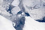
ice bridge

image

Monday, September 18th, 2017

NASA Flights Map Summer Melt of Greenland Ice

Operation IceBridge is flying in Greenland to measure how much ice has melted during the summer. The flights, which began on Aug. 25, 2017, and will go on until Sept. 21, 2017, repeat paths flown this spring and aim to monitor seasonal changes in the elevation of the ice sheet. “We started to mount these