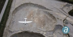
Montreal, Canada, April 20th, 2021 – SimActive Inc. and Quantum-Systems GmbH, world leaders in photogrammetry software and drone platforms respectively, are pleased to announce the successful integration of their products. Data captured with the Quantum-Systems Trinity F90+ mapping drone can be processed in SimActive’s Correlator3D software to generate DSMs, DTMs, point clouds and orthomosaics. Data from high-precision sensors such as PPK receivers, survey-grade color and multispectral cameras and LiDAR are all fully supported. “The data collected by our drones can be quickly converted into highly accurate maps with SimActive software”, said Stefan Wurmser, Training Manager at Quantum-Systems. “Correlator3D can also easily handle large datasets comprising tens of thousands of images.” “The combination of Quantum-Systems’ drones with Correlator3D leads to a complete solution to survey extended areas,” said Philippe Simard, President at SimActive. “Our LiDAR workflow can also leverage their LiDAR solutions, offering users with point cloud colorization capabilities.”
About Quantum-Systems
Quantum-Systems GmbH, founded in Munich in 2015, specializes in the development, design, and production of small Unmanned Aircraft Systems (sUAS). Our sUAS combine eVTOL (electrical vertical take-off and landing) capabilities with long-range utilizing electrical and aerodynamic efficiency. We continuously integrate high precision sensors into our systems for increased aerial data intelligence. Using these methods, we are transforming decision-making processes for the professional user in both the commercial and governmental sectors. For more information, visit www.quantum-systems.com.
About SimActive
SimActive is the developer of Correlator3D™ software, a patented end-to-end photogrammetry solution for the generation of high-quality geospatial data from satellite and aerial imagery, including drones. Correlator3D™ performs aerial triangulation (AT) and produces dense digital surface models (DSM), digital terrain models (DTM), point clouds, orthomosaics, 3D models and vectorized 3D features. Powered by GPU technology and multi-core CPUs, Correlator3D™ ensures matchless processing speed to support rapid production of large datasets. SimActive has been selling Correlator3D™ to leading mapping firms and government organizations around the world, offering cutting-edge photogrammetry software backed by exceptional customer support. For more information, visit www.simactive.com.
