 About 1200 participants from all over the world gathered in Moskau, Russia recently to celebrate the ICA’s 23rd International Cartography Congress (ICC). Countries from all over the world were represented, most of them members of the International Cartographic Association. A rough estimate would divide the participants into four cultural groups of equal size; ‘the Western’, ‘Russia and East-Europe’, ‘China’, and ‘all other parts of the world’.
It was great to be together with all of these different people and cultures. However, it seems at these kinds of occasions that the cultural groups tend to bunch together rather than spread and mix across cultural borders. Westerners tended to go to westerner’s presentations etc. Maybe it can’t be different. But it should continue to be one of the major aims of ICC to have cultures mixed. Despite this cultural grouping the 1200 participants presented approximately 700 papers and poster. This means that nearly every second participant made a presentation! A remarkable growth.
{sidebar id=14}
The variety of the presented papers and posters was enormous: mapping of Saturn’s moons, maps for blind people, maps for children, as well as finer mathematical problems.
At the opening ceremony Ferjan Ormeling and Menno-Jan Kraak presented an interesting key-note speak. They described and discussed a growing gap between geoinformation-cartography-theory on one side and the map-maker’s everyday life. These two domains separate more and more from each other.
Thanks to modern production tools is it possible for nearly everybody, who wants, to produce ‘some kind of maps’. Unfortunately, to be able to handle modern production tools it is not necessary to know the theory (on geo-information and cartography). The result is that premises, documentation and systematic suffer heavily, not to say that these things are not present. On the other side, as emphasised by Ormeling and Kraak, it must also be said that the cartography-theory-domain has not followed the general development within the production-domain.
{sidebar id=15}
Michael Peterson made a kind of follow-up on Ormeling and Kraak’s key-note speak with his paper ‘Maps on the Internet: What a mess and how to fix it’. The paper points out that only very few people actually utilize the Internet-media’s possibilities for interactivity. But that is not the worst thing. The worst aspect of maps on the Internet is the commercialization of the access to the Internet. The users pay for the access to the Internet and not for the content (roughly speaking). This means that the content-producers (both cartographers and map-makers) have very low incitement to produce high-quality content. A third point made by Michael Peterson is that outside the ‘western world’ the most common portal to the internet is a mobile device with a small screen. This also reduced the incitement to create nice and efficient maps.
An interesting part of the presented papers was the question regarding ‘copyright and digital media’. Different initiatives have been taken to solve the problem of e.g. ‘watermarking’ one’s digital maps or ‘putting finger-prints’ into digital maps. One attempt is to hide special information inside a dataset’s coordinates. Unfortunately, it does not seem that a general and stable solution has been found yet.
One particular paper should be mentioned here. Spanish colleagues told about their hydrographical SDI (spatial data-infrastructure), ‘An Approach Towards a Harmonized Framework for Hydrographic Features Domain’. {sidebar id=16}The paper presented an everyday life with problems and followed up by explanations why the problems occurred. The authors have recognised that the Hydrography-SDI is characterised by major un-systematic, and that this causes severe production problems. The presentation was very detailed and focused, and it also explained what should be done. Directly after this paper another paper on GSDI ‘An Initial Model of the Computation Viewpoint for a Spatial Data Infrastructure’ was presented by Cooper, Mollering, Hjelmager et al. It was interesting to see the two papers in conjunction, one presenting everyday life and the other presenting a theoretical approach. Together they give a quit good overview of what is going on, and they represent the hope that someday there will be sufficient systematic structure in the GSDI.
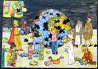
{sidebar id=17} The map exhibition suffered, more than ever, from static display of static paper maps. Static paper maps are only a smaller part of today’s world of maps, and paper maps do certainly not represent the major development achieved. On the other side, it must be admitted that is seems very difficult to create a map-exhibition containing all sorts of electronic maps. One exception from the static feeling was the display of children’s maps. All the children’s maps were drawn on paper with colour-pencils, and still representing fantasy and good stories. ICA’s general assembly takes places every four years. It was time for that in Moskau.
As it is the case with most general assemblies, nothing dramatic happened at ICA’s general assembly in Moskau. Bengt Rystedt retired from the management of ICA after more than 20 years in charge. Milan Konecny retired as president, and Ferjan Ormeling retired as ICA’s secretary general. William Cartwright, Australia, was elected new president, and David Fairbairn, Scotland, was elected new general secretary.
The 24th International Cartographic Conference will take place in Santiago, Chile in November 2009. After that, in 2011, Paris will host the 25th ICC.
Lars Brodersen is a columnist for V1 Magazine. He is Associate Professor for Geo-communication and geo-information at Aalborg University, Denmark.