Monday, August 15th, 2011
Luxembourg based AES Astra emerged in the 1980’s during a critical time when television was expanding and re-inventing itself as a powerful communication medium, and satellite television was new. The growth of Astra was aligned with the development of global perspectives on many fronts. Global collaboration, worldwide news, high definition television along with mobile viewing

Wednesday, July 6th, 2011
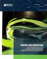
Water is a valuable resource. As the world population continues to grow and urban development continues to expand, cities are expanding and water infrastructure is demanding greater attention. Leakage is a primary contributor toward water loss. As a result, water agencies, engineers, urban planners and officials are developing strategies to deal with this problem. Leakage
Sunday, June 26th, 2011
There is a difference between the cities that we live in today and those that we need to be living in. Editors R. Klanten and L. Feireiss include images and concepts about architecture, city planning, urbanism and other representations that challenge our thinking about current cities. A triad of architecture, mobility and energy is expanded upon, and
Sunday, June 5th, 2011
Which data should we use? Is it accurate enough to be used with our model? Will it address the issues and provide us with new insight we can depend upon? How much error is too much? Will the spatial data describe the model we are using without excessive error? Many geographic information system (GIS) users wish
Saturday, May 21st, 2011
Signage and wayfinding are integral elements for all structures. Signs help us to understand architecture and infrastructure, and communicate about the identity of a structure. Design is a key aspect for developing effective signage and this book includes a large number of international examples where design, communication and identity come togeher to help us experience
Monday, May 9th, 2011
Thinking About GIS is exactly that. Whether one is looking to begin a GIS project or is already involved in GIS operations and solutions but needs guidance and help, this book provides answers. Roger Tomlinson has thought about GIS from all aspects, from operations to management. He brings a wealth of experience and knowledge to
Sunday, April 3rd, 2011
Cities are undergoing great change today. Changing climate, economics, population growth and technological innovation are all contributing toward changes within cities that result in renewal, sustainable designs, adaptation and development that addresses issues of sustainability. Green urbanism attempts to address these pressures. Author Steffen Lehmann is UNESCO Chair in Sustainable Urban Development. A German architect,
Monday, March 14th, 2011
Sustainable development implies consideration of environmental, economic and social factors. For engineers this leads to the design of infrastructure upon the landscape that meets the goals of sustainability. T.G. Carpenter takes it a step further and writes about the performance of sustainable infrastructure upon multi-discplinary approaches including hydrology, ecology and aesthetics.
Saturday, January 8th, 2011
Geospatial technologies have evolved to become not only widely popular but necessary for those seeking to generate an economic advantage. Individuals, businesses and governments can all gain the benefits of location based applications. ‘Why ‘Where’ Matters: Understanding and Profiting from GPS, GIS and Remote Sensing’ is written so anyone can understand location-based tools and other geospatial
Monday, December 13th, 2010
Geographic information systems (GIS) have evolved from being desktop focused software to become internet oriented and offered as web services. Today many people actively engage GIS through web services delivered over the internet. These activities are continuing to expand and will undoubtedly offer the widest variety of spatial information services well into the future, providing