Aerial photographs from Bluesky are helping farmers and rural estate managers gain a greater understanding of the environment in which they work. Working with Pear Technology, a developer and supplier of land and crop management software, Bluesky has supplied aerial photographs to enhance the overall digital mapping experience. The map accurate images provide an easy to interpret backdrop for Ordnance Survey mapping providing clear, up to date and useable contextual detail for a range of rural applications.
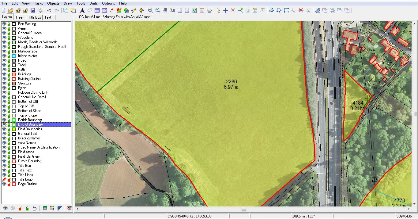
The high resolution aerial imagery from Bluesky is being used within PT Mapper a desktop Geographical Information Systems package specifically designed for farming applications. Easy to use, PT Mapper facilitates the measurement of areas and distances at a glance. It enables the preparation of any type of management or record map including, Land Registry, maintenance and waste management, soil management, ELS and HLS plans, utilities and tenancy plans. Using PT Mappers farmers can also show cropping plans, show and measure field margins, print whole maps or part maps, at any scale.
Tim Hopkin of Pear Technology commented, “Our customers tend to be non IT specialists – they understand the land and what they must do to it to earn a living but they may struggle with some of the bureaucratic demands placed on them. The combination of Bluesky’s aerial photography with our own desktop mapping solutions makes the production of management reports, KPI returns and supporting maps much easier.”
“Initial reports from our customers indicate that the Bluesky images are proving especially useful for project and asset management. They are also delivering returns in the preparation of grant applications, research and site analysis. Specifically feedback from end users describes the aerial photographs as clear, relevant and useable. They are up to date and show far more contextual detail than mapping alone.”
The aerial photographs supplied by Bluesky are taken from their off the shelf archive which covers the whole of England, Scotland and Wales. Continuously updated on a five year rolling data capture programme the high resolution digital images files are available in a range of formats suitable for use in desktop mapping, GIS and CAD software packages.
Bluesky is a UK-based specialist in aerial imaging and remote sensing data collection and processing. An internationally recognised leader with projects extending around the globe, Bluesky is proud to work with prestigious organisations such as Google, the BBC and Government Agencies.
Bluesky has recently invested in the latest multi sensor technology which combines a high performance LiDAR, Thermal Sensor and RGB Camera in one system. This system is a world first and puts Bluesky at the cutting edge of remote sensing data collection.
Bluesky has unrivalled expertise in the creation of seamless, digital aerial photography, DTMs, DSMs and 3D landscape/cityscape visualisations and prints. Bluesky is also leading the way by developing innovative solutions for environmental applications including the UK’s first detailed, nationwide tree map as well as solar potential reports, citywide ‘heat loss’ maps, 3D and historical imagery. www.bluesky-world.com
Pear Technology was formed in 1995 and soon became a leading supplier of digital mapping and crop management software for the farming and rural industries. With a background of supplying complex software to users who are non-IT specialists, they have adapted their mapping and GIS products so that they also meet the requirements of a wider range of users – typical examples being arborists, local councils, building suppliers, marinas, property, housing associations, universities and colleges. www.peartechnology.co.uk
