Monday, October 4th, 2010
International communications and information technology company Harris Corporation and leading Middle East telecommunication systems and security provider Atlas Telecom, have today announced the launch of a new joint venture. The company, to be known as Harris Atlas, will deliver innovative intelligence solutions such as enhanced video management and geospatial 3D visualization specifically designed for the UAE. The
Monday, October 4th, 2010
Sensis, a wholly owned subsidiary of Telstra, Australia’s largest mobile network operator and deCarta, the market leader in location-aware software, today announced that deCarta’s geospatial software platform will provide the maps and directions for Sensis’ online and mobile applications, including Yellow Pages, White Pages, Citysearch and their leading mapping website Whereis.com. Sensis is the leading directory
Monday, October 4th, 2010
Thanks to Nova Studio, design your interactive 3D scenes with the solution which fits your needs. Diffuse your work through executable files, web pages, High Res screen captures or videos. Read More
Monday, October 4th, 2010
This is a gentle reminder about the Consultative Group on International Agricultural Research (CGIAR) and Earth Systems Science Partnership(ESSP) invitation to participate in a survey of crop modelling, climate change and food security. If you have not already done so, could you please follow the link below and complete the survey?
Monday, October 4th, 2010
The hills of San Francisco, a beloved garden, and bountiful California sunlight converge in the award-winning Diamond Project, an innovative home designed in ArchiCAD building information modeling (BIM) software. Built by Terry & Terry Architecture of Berkeley, Calif., the project won a 2010 AIA Housing Award, whose jury called it “crisp and sculptural, exquisitely detailed. It
Monday, October 4th, 2010
The Airborne Gravity 2010 workshop was held on the 22 August 2010 as part of the recent 2010 ASEG-PESA 21st International Geophysical Conference and Exhibition in Sydney, Australia. The objective of this workshop was to provide a review of the advances in airborne gravity since the Airborne Gravity 2004 Workshop. A joint publication by Geoscience

Sunday, October 3rd, 2010
The annual Association for Geographic Information (AGI) conference in the United Kingdom was held last week in Stratford-Upon-Avon. With about 490 registered for the event, the conference was split into six sessions including Geospatial Foresight, The Power of Free, Geoweb and the Cloud, Governance and Management, Environmental Concerns and Delivering on Policy.

Sunday, October 3rd, 2010
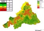
The reduction of land maintenance actions has determined a need for awareness about soil conservation issues. The main consequence is an increasing soil loss due to flash flood or similar phenomena. This issue needs a new approach leading to a continuous analysis and monitoring action. This part’s aim is to describe the main steps of
Sunday, October 3rd, 2010
The search for individuals, organizations, governments and private enterprises that have demonstrated leadership in preparing for, responding to, and reducing the environmental impacts of disasters and conflicts has begun with the launching of the 2nd biennial Green Star Awards. Nominations are being received until 30 November 2010 with the awards ceremony taking place in May
Sunday, October 3rd, 2010
The HUMBOLDT Alignment Editor is a RCP application that allows to interactively design transformations on a conceptual schema level. It supports import of schemas from different sources, such as Eclipse ecore, WFS and GML Application Schemas. The defined transformations are stored either locally or in the HUMBOLDT Model Repository and used by the Conceptual Schema Transformer