Sensors and Systems
Breaking News
NASA-Led Study Provides New Global Accounting of Earth’s Rivers 
Rating12345A study led by NASA researchers provides new estimates...
geothinQ Rebrands to Latapult, Reflecting Company’s Mission to Empower GIS Data Use for Decision-Making
Rating12345Savannah, Georgia – geothinQ, a premier geographic information system...
Sanborn’s Broadband Navigator™ is Available for Streamlined Purchase on NASPO
Rating12345 The Sanborn Map Company’s (Sanborn) Broadband Navigator™ is...
  • Rating12345

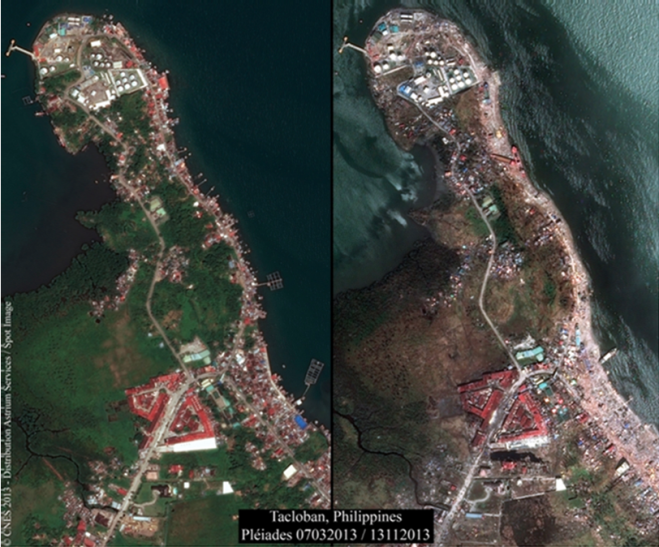
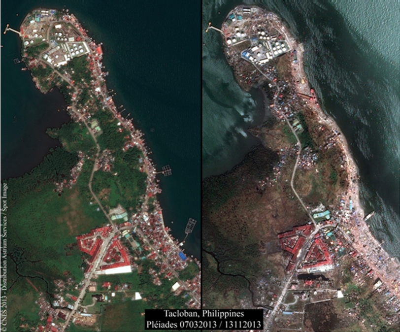
The effects of Typhoon Haiyan, which hit the Philippines on November 8 2013, were photographed on 13 November 2013 by a Pléiades satellite, which had captured images of the same zone (Tacloban) on 7 March 2013.

Astrium builds and operates the Pléiades high-resolution satellites that are providing such images within the framework of the International Charter on Space and Disasters. These images are being made available to rescue teams and authorities.
Astrium Tecloban

These high-resolution images can be downloaded here: ftp://ftp.astrium-geo.com/Philippines/

Leave a Reply

Your email address will not be published. Required fields are marked *