
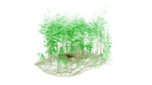
 GeoSLAMs LiDAR technology is mapping forests as part of the Centre for Research-based Innovation (SFI) SmartForest in Ås, Norway. SFI SmartForest aspires to put the Norwegian forestry sector at the forefront of technological advances and Industry 4.0.
Led by The Norwegian Institute of Bioeconomy Research (NIBIO), the SFI SmartForest aims to bring industry 4.0 to the sector over an 8-year period. The primary goal is to improve the efficiency of Norwegian forestry by enabling a digital transformation, using innovative technologies. They want to increase productivity, reduce environmental impacts and review other significant climate benefits.
Focusing on silviculture, forest operations, wood supply and the overall digital information flow, SmartForest is investing in sensible enabling technologies such as handheld LiDAR sensors to help achieve its goals.
Walking and scanning with the ZEB Horizon captures data from beneath the forest’s canopy. Projecting 300,000 laser points per second with a range of up to 100 meters, the scanner produces dense 3D models of large areas in a short period of time. The accurate point cloud data includes the forest floor, debris, tree trunks and thick vegetation. When needed, UAVs capture the heavy vegetation of the forest canopy, merging both datasets.
The team, headed by center manager Rasmus Astrup, regularly captures point cloud data in 250-square-meter plots of land, with a further ambition to scan larger areas in the future.
