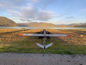
The S2 UAS is ready for deployment on its pneumatic launcher at Dutch Harbor airport in Alaska. (Credit: Aleutian Aerial/Andy Dietrick)
The ability to provide a “volcano forecast” could help reduce the significant health, safety and even economic impacts of eruptions; they regularly disrupt aviation and the global supply chain we depend on. Last fall, circling the summit of an active volcano, a small aircraft moved us toward a future where remote but hazardous volcanoes are consistently monitored for signs an eruption could be brewing.
This unmanned aircraft system (UAS), commonly known as a drone, was specially designed for scientific uses in challenging environments—and then upgraded to become an airborne volcano-observing platform. With flights to Makushin Volcano in Alaska’s Aleutian Islands in September 2021, a group of federal scientists and industry engineers demonstrated the UAS could successfully fly without its pilots’ eyes on the aircraft. And that opens new possibilities for monitoring volcanoes and other hazards worldwide.
