 Whether it is connecting cross-border data, collaborating with global geospatial communities or building bridges between geographic, social or other statistical information, EuroGeographics is firmly founded on the principle of trans-boundary cooperation. As the membership association representing Europe’s national mapping, land registry and cadastral agencies, it is at the forefront of many initiatives designed to improve and deliver cross-continental projects and services. EuroGeographics currently brings together 53 organisations (more are expected to join in the coming months) from 43 countries who between them speak some 40 different languages. Its workforce is also spread throughout the region.
Crossing these geographic, economic and cultural differences to provide a strong, unified and well-respected voice is a challenge that the association has overcome by focussing on common interests, shared experiences and an innovative use of communications technology. It is also relocating its head office from Paris to Brussels to place its operations at the very heart of European political life and decision-making.
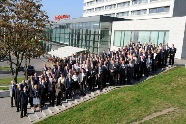
Ensuring that our members can contribute to key policy developments, initiatives and projects, is central to our activities,” explains Dorine Burmanje, EuroGeographics’ President. “We achieve this by providing a platform for the exchange of information and best practice through the use of webinars and online forums as well as face-to-face meetings. In this way we provide a single point of contact for organisations wanting to benefit from the collective expertise and advice of our members. Without their willingness to work together, we simply would not be able to provide this vital link between national mapping, land registry and cadastral agencies, governments, businesses and other geospatial specialists.”
Connecting cross-border data
Eurogeographics’ activities come together in a number of spatial data infrastructure (SDI) projects providing services to access information from different data providers across Europe. These focus on supporting the implementation of the INSPIRE Directive through the delivery of the definitive location framework for Europe using the high quality, definitive reference data already available from national mapping, land registry and cadastral agencies. This principle of creating data once to be used many times demonstrates how EuroGeographics and its members add value at both national and European level and, because it comes from official sources, users can have confidence in the information provided.
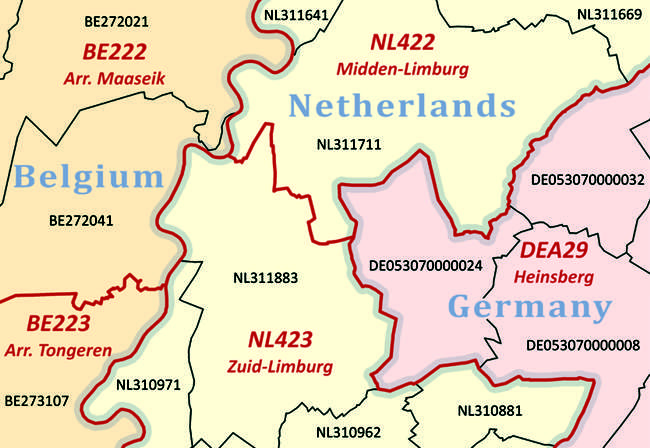
Cross-border data initiatives include the State Boundaries of Europe project to deliver a multi-purpose database of precise geometric descriptions of administrative and legal definitions for European international boundaries. This uses a common data model and network, together with information from associated treaties, to produce data at the highest accuracy possible to meet the needs of users such as Frontex and the European External Border Surveillance System (EuroSur). In the short-term, the project aims to provide a solution for INSPIRE edge-matching at national borders and works closely with the ESDIN consortium to support this.
Five of EuroGeographics’ Nordic members – Denmark, Finland, Iceland, Norway and Sweden – are also involved in a collaboration to develop an Arctic Spatial Data Infrastructure. This first ever Arctic Mapping Service, developed by the Arctic Council’s eight members, will provide the best available reference data, as well as thematic maps, of the region.
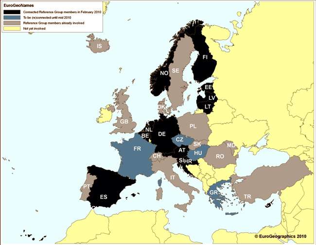
EuroGeoNames
A good example of members working with academic, private and public partners to produce pan-European data is the EuroGeoNames project to create an authoritative multi-lingual geographical names infrastructure. This was completed in 2009 and received very positive feedback from reviewers and the European Commission (EC).
Part-funded under the EC’s eContentplus programme, it uses official sources to provide reliable, comprehensive information about geographic names both in the form used by the country of origin (endonym) and by other countries (exonym). This helps to overcome the difficulties caused by language which can result in places being known by several different names.
EuroGeoNames also offers a sustainable approach to updates; a service-based infrastructure for both the collection and delivery of data and a web interface that allows simple live searching.
The web service is a prototype implementation for an INSPIRE gazetteer enabling European Union (EU) member countries to meet their legal obligations simply by linking their data to it. EuroGeoNames has been adopted by the European Spatial Data Infrastructure Network (ESDIN) as an example service in a European Spatial Data Infrastructure (ESDI).
EuroGeographics is now leading the next phase of the service’s development – its implementation for an increasing number of countries in Europe and testing by those involved in the INSPIRE geoportal. A pilot version is anticipated later this year.
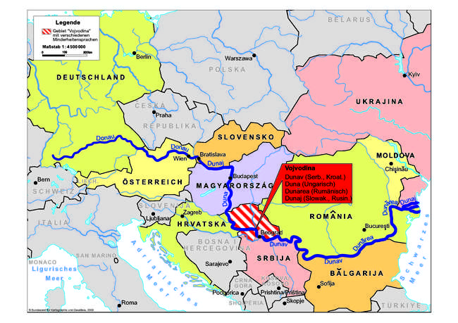
ESDIN
Significant achievements have also been made by ESDIN, demonstrating the progress that can be made when people from different communities work across boundaries with a common purpose.
ESDIN involves a range of partners and is another project making a significant contribution to INSPIRE by helping to develop services to integrate existing national SDIs to create the definitive pan-European location framework.
As coordinator of the consortium, EuroGeographics recently announced that the project has achieved what it believes is a world first in delivering geospatial quality evaluation at any point in a production flow line through semi-automated web services. The ground-breaking research involves EuroGeographics’ members and is being supported by a number of universities and companies including 1Spatial, who worked on the automatic conformance testing and quality assured data processing using the object-orientated and rules-based approach of Radius Studio.
EuroGeographics’ Programme Manager, Antti Jakobsson provides coordination and leads the project work package associated with metadata and quality and is very excited by the findings. “Web services can now be used in an automated and semi-automated manner for quality control during production and post-production quality evaluation. This approach will greatly help data users to evaluate usability and fitness for purpose using metadata information,” he says.
“This web service model for geospatial data quality can have a positive impact in several areas. Not only does it introduce a common quality model for large and small scale datasets that uses the same principles for all INSPIRE Annex I data themes, offering a guideline for INSPIRE implementation, but it is also based on conformance levels that can be evaluated using semi-automated or automated procedures based on agreed and accepted ISO standards.
“In addition, the web service model provides metadata guidelines for both discovery and evaluation metadata, enables the automation of quality evaluation and conformance testing and takes accreditation principles and usability into account.” The project has also tested and provided feedback on INSPIRE Annex 1 Theme Draft Implementation Rules, edge-matching methodologies for cross-border data consistency and ExM transformation specifications.
ESDIN is co-funded by the EC’s eContentplus programme and focuses on the implementation of new strategies to provide INSPIRE compliant data based on a distributed architecture, helping organisations to meet the requirements of the Directive.
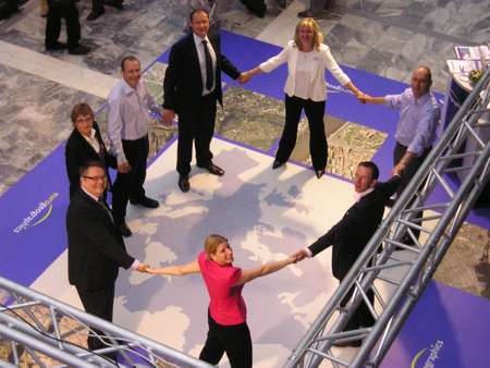
Collaborating with global geospatial communities
EuroGeographics’ Executive Director, Dave Lovell believes that the development of SDIs is crucial now that technology has driven geographical information into the mainstream.
“Today we are using services underpinned by SDIs rather than products to access information about places and spaces,” he says. “Whilst interest in our members’ reference information, products and services remains strong, they recognise that the geospatial sector is more complex, competitive and compelling than ever before. This means they must continue to demonstrate their expertise in providing the authoritative, definitive and high quality data needed to realise the ESDI. Our projects show that using their readily available data not only avoids duplication in both the collection and management of geospatial information, but also ensures compliance with existing legislation and compatibility with EU member state policies.
“Whilst Europe has certainly taken the lead in providing SDI services with the INSPIRE Directive, its principles can be applied to the wider geospatial community and we are committed to establishing mutually-beneficial relationships with like-minded organisations; our pioneering strategic collaboration with PSMA Australia, which provides a strong link between the government agencies responsible for spatial data across two continents, is just one example.”
PSMA Australia and EuroGeographics share similar business attributes, values, challenges and strategies to deliver continental datasets and SDIs. Both aspire to deliver benefits to the wider spatial and non-spatial communities through their support of spatial community development. Their groundbreaking memorandum of understanding is an agreement to work more closely together and focuses on a collaborative approach to research, technology development and innovation and joint investment that means, where possible, the organisations will combine resources to go further and faster more cost effectively.
EuroGeographics has strategic memorandums of understanding with a number of other organisations such as the European Land Information Service (EULIS), European Spatial Data Research (EuroSDR), the Permanent Committee on the Cadastre in the EU (PCC) and the United Nations Working Party on Land Administration (UN-WPLA). Its most recent was signed with the European Umbrella Organisation for the Geographic Information Community (EUROGI) who will work with EuroGeographics to support geo-spatial developments in Central and Eastern European countries.
The association also continues to work with the International Association of Geodesy (IAG), the European Land Registry Association (ELRA), the Reference Frame Sub-Commission for Europe (EUREF), the Council of European Geodetic Surveyors (CLGE) and Geometer Europas (GE) as well as maintaining strong, productive links with EuroGeoSurveys, the Association of Geographic Information Laboratories for Europe (AGILE), the International Cartographic Association (ICA) and the International Federation of Surveyors (FIG).
EuroGeographics’ head office represents members in the Global Spatial Data Infrastructure Association (GSDI) and the association remains an active liaison member of the European Standardisation Committee (CEN) and a liaison member of ISO TC211. During 2010 it plans to develop a closer relationship with the Open Geospatial Consortium (OGC).
Building bridges between statistical, social or other information
Information provided by national mapping, land registry and cadastral agencies about location, ownership, value and use, is being linked in more ways than ever before to other data allowing greater analysis of statistics and more accurate forecasting of trends. This routine use of location information has created a spatially-enabled society which relies upon geospatial data for policy decisions, business and leisure. Indeed topologically structured data is most often used in proximity, network and other spatial analysis.
In this sense members of EuroGeographics are transcending the traditional boundaries of the geographical industry by providing data as a foundation for a wide range of services. For example OneGeology-Europe is using EuroGeographics’ EuroGlobalMap, a 1: 1 million scale topographic dataset, to underpin its web services and the same product is also used by the INSPIRE geoportal as a background map.
The association’s 1:100 000 scale administrative and statistical seamless dataset, EuroBoundaryMap is widely used in the EC as an integral part of its GISCO reference database, to provide easy and rapid access to comparable statistics, Eurostat collects, processes and distributes European economic, geo-demographic and social information on all EU and candidate countries and uses the dataset, for example, in the Urban Audit and for spatial analysis in the Labour Force Survey.
The Environment and Nature Planning Bureau in The Netherlands uses EuroRegionalMap, a multi-functional topographic reference dataset covering 35 countries at 1: 250 000 scale, in its EUrbanis project to assess the quality of life given current and future urbanisation patterns.
“Whether the aspirations are national, continental or global, a willingness to work together is essential to the successful establishment of SDIs which in turn are vital to a spatially-enabled society reliant on accurate, authoritative geospatial data,” concludes Mrs Burmanje. “In today’s climate of economic uncertainty and constant social and technological change, the definitive location framework being developed by our members is crucial to building a well-governed, competitive and sustainable European economy which benefits all citizens. In the 21st century, however, their expertise and experience is extending far beyond the boundaries of Europe enabling them to play their part in worldwide projects and initiatives.”
For more information about EuroGeographics or to get involved in its activities, please visit www.eurogeographics.org. To see its members’ geographical information in action and learn more about the recently completed EuroGeoNames project, visit www.youtube.com/eurogeographics.