 Two events took place in Nessebar, Bulgaria recently. These were organized by the University of Architecture, Civil Engineering and Geodesy (UACEG) under the patronage of the Kristalina Geoggieva, Member of the European Commission. The events were the 3rd ISDE Digital Earth Summit, with co-organizer International Society for Digital Earth (ISDE) and The 3rd International Conference on Cartography and GIS, with co-organizer International Cartographic Association (ICA).
Supporting the quality and high level of the organized events are the auspices of the Bulgarian Commissioner Kristalina Georgieva. Both events were also supported by the mayor of Nessebar Mr. Nikolaj Dimitrov. They were reported in international, national and regional media. Official partners were V1 Magazine, Geoconnexion International Magazine and Geomedia.
From the 12th to 14th of June 2010 the 3rd ISDE Digital Earth Summit with the cooperation of the dean of UACEG – Sl. Gospodinov took place.
Bulgaria is now one of the few countries which have organized events for the International Society for Digital Earth (ISDE) after New Zealand (2006) and Germany (2008). Symposiums of Digital Earth were organized in China (1999), Canada (2001), Czech Republic (2003), USA (2007), China (2009). The next one will be held in Australia (2011) (http://www.isde7.net/).
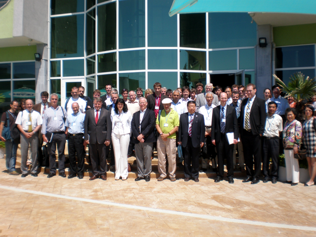
As far as the participation is concerned, the statistics show 6 keynote speeches, 45 presentations, and 110 authors from 17 countries – 10 reports from China and Germany, 5 from Czech Republic, 4 from Italy, 3 from Bulgaria, 2 from USA and 1 from Argentina, Belgium, India, Iran, Japan, New Zealand, Netherlands, Sweden and Great Britain.
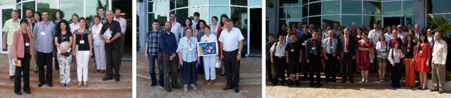
The participants in the 3rd ISDE Digital Earth Summit
The keynote speeches, which were presented twice per day, were presented by notable scientists:
1. Prof. Huagong Guo, China, on subject: Decadal Development and Future of Digital Earth;
2. Dr. Paul Hardy, ESRI, Digital Earth: Collecting, Connecting, Analyzing, and … Action;
3. Dr. Robert Nagy, Intergraph, Realizing the Digital Earth Vision – Intergraph Experience;
4. Dr. Natalie Stephanne, Eurosense, Supporting Authorities by Digital Earth Services for Preventing Risks, Assessing Damages and Monitoring Critical Assets;
5. Dr Alessandro Annoni, EC, JRC: A European Perspective on Digital Earth;
6. Prof. Deren Li, China, From Digital Earth to Smart Earth.
During the Summit three meetings of the Executive Board of Digital Earth were held, led by the vice president of ISDE Prof. Milan Konecny from the Czech Republic and the General Secretary Prof. Huagong Guo from China. A very important event was the round table on a theme “Digital Earth in Europe” led by Alessandro Annoni, EU, Head of SDI, JRC, Ispra, Italy.
Special thanks to sponsors ESRI, Eurosense, Intergraph and GEODIS!
More information about the 3rd ISDE Digital Earth Summit and the presented reports can be found at www.cartography-gis.com/digitalearth.
From 15th to 20th of June, 2010 the 3rd International Conference on Cartography and GIS took place. The event was supported by the Rector of the UACEG Prof. Dobrin Denev. The conference was held incorporating the International Cartographic Association Regional Symposium for Central and Eastern Europe.
A very important part of this conference was The Seminar with EU cooperation on early warning and disaster/crisis management under the auspices of the Czech ambassador to Bulgaria His Excellency Mr. Martin Klepetko. Another important event Workshop ICCG3 on theme “Infrastructure of spatial data: an opportunity for data exchange in South East Europe” was organized by Dr. Ulrich Boes.
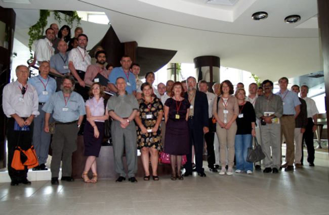
After two successful conferences held in Borovets in 2006 and 2008, the third edition of this series showed growth not only on historical but also on geographical level: 6 keynote speeches, 110 presentations, 190 authors from 32 countries. For the first time in the history of the conference, the reports from Bulgaria were the most – 26. Other reports were presented by scientists from the Czech Republic (10), China (9), Iran (8), Russia (7), Greece(6) and Turkey(6). Three reports from Albania, Macedonia, Germany, Hungary, Netherlands and Spain, 2 from Australia, Belgium, Egypt, Croatia, Romania, 1 from Argentina, Austria, India, Malaysia, Mexico, Nigeria, Poland, Switzerland, UAE and Kosovo were also a part of the conference programme. Some of the reports were not presented in Nessebar, due to the deny for visas from various Bulgarian embassies.
The keynote speeches were presented in special sessions by:
1.Dr. Paul Hardy, ESRI: Scaling-up Cartography – Cloud Computing and Multi-scale Content for Tomorrow’s Mapping;
2. Dr. Miklos Gross, Eurosense: The Mission of Cartography in the Modern Information Sociality;
3. Dr. Athina Trakas, OGC: Interoperability from a global perspective;
4. Prof. Joachim Rix, Germany: Spatial Data Infrastructures: The Subnational Dimension in the European Context;
5. Assoc. Prof. Dr. Temenoujka Bandrova, Bulgaria: Bulgarian Cartography: from Paper to Virtual Reality;
6. Prof. William Cartwright, Australia, President MKA: Maps, Sketches and Annotations: Representations of the Geography of Conflict – Gallipoli 1915.
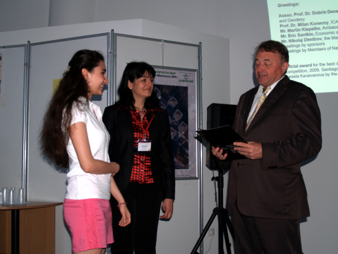
During the opening ceremony, the 15 years old Daniela Karaivanova received her international award for best children’s drawing from the International Competition “Barbara Petchenik”. The award was given during the 24th International Cartographic Conference in Santiago, Chile, 2009. The Diploma was bestowed by the past President of ICA, Prof. Milan Konecny.
Two commissions and a working group form ICA held their annual meetings during the conference:
1.Commission on cartography and children with chairs: Jesus Nunez, and Temenoujka Bandrova
2.Commission on planetary cartography, chaired by: Kira Shingareva
3.Working Group on cartography and early warning and crisis management with Chair: Milan Konecny.
During the meetings the upcoming tasks and the common projects of the commissions were discussed.
The next annual meetings will be held in Paris during the forthcoming 25th International Cartographic Conference, 2011.
Special thanks to sponsors of both events ESRI, Eurosense, Intergraph, GEODIS and Datamap-Europe! More information about the ICA and the presented reports can be found at www.cartography-gis.com.
Representatives of the Bulgarian government have also took an interest. Alexander Lazarov, Director of the Agency of Geodesy, Cartography and Cadastre attended the conference. From the Ministry of Transport, Information Technology and Communications Liliana Turnalieva, Head of Spatial Data EA ESMIS took part in the events. Ministry of Interior was represented by experts from civil protection from local and regional level.
——————————————————————————-
Temenoujka Bandrova
Department of Photogrammetry and Cartography, UACEG, Sofia, Bulgaria
