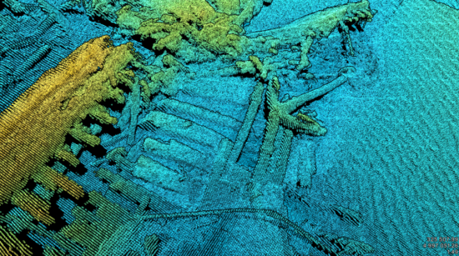

Ship-mounted laser-scanner data show the Ogarita shipwreck at the bottom of Lake Huron.
A laser scanner mounted to ships and submarine vehicles is providing high-resolution images of underwater features, including shipwrecks. The ULS-500 PRO scanner from 2G Robotics uses a high-sensitivity, low-noise sensor to reach ranges previously unattainable with laser scanning, resolving fine-scale dimensional features from distances as far as 20 meters.
The system was used offshore during recent trials and deployments. In one example, it was mounted to a vessel to dynamically scan shipwrecks in Lake Huron.
“The laser data is very dense, and, at standard survey speeds of 4-5 knots, the ULS-500 PRO captured over 6,500 points per square meter,” noted Kevin Tomanka, the senior hydrographer and data processor at OARS who operated the deployment. “Similar to the advent of Multibeam Echosounders into mainstream usage over the last few decades, laser point data combined with digital still images will be the new standard for high-resolution seabed mapping going forward.”


