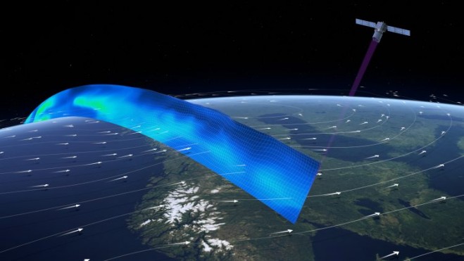

When launched, the ADM-Aeolus satellite will carry the first wind LiDAR in space, which can probe the lowermost 30 kilometers of the atmosphere to provide profiles of wind, aerosols and clouds along the satellite’s orbital path. (Credit: ESA/ATG medialab)
The pioneering Aladin sensor, a spaceborne LiDAR instrument with two powerful lasers, a large telescope and very sensitive receivers, is ready to join its Aeolus satellite for launch in 2017.
Designed by Airbus Defence and Space, Aladin’s laser generates ultraviolet light beamed toward Earth, which bounces off air molecules and small particles such as dust, ice and droplets of water in the atmosphere. The receiver analyses the Doppler shift of the backscattered signal to determine the speed and direction of the wind at various altitudes below the satellite.
These near-real-time observations will improve the accuracy of numerical weather and climate prediction and advance our understanding of atmospheric dynamics and processes relevant to climate variability.


