Tuesday, May 23rd, 2017
More and more industries and manufacturers are requiring sensors for condition monitoring in their machines or processes. New digital signal conditioner technology is now available that simplifies the use of eddy current (inductive) displacement sensors for high precision/high reliability applications. The technology is the best option for monitoring movement, position, vibration, alignment, or deflection, especially
Wednesday, May 10th, 2017
By Will Meenan, Kaman Precision Products More and more industries and manufacturers are requiring sensors for condition monitoring in their machines or processes. New digital signal conditioner technology is now available that simplifies the use of eddy current (inductive) displacement sensors for high precision/high reliability applications. The technology is the best option for monitoring movement,
Monday, January 30th, 2017
January, 2017 — For professional photogrammetrists, the objective of mapping is not just to generate simple 2D orthomosaics and 3D visually-pleasant models, but to create cartography that provides accurate location and precise measurements. In Pix4Dmapper Pro, users can process large-frame images with an additional add-on. This add-on is for processing images larger than 55 megapixels.
Thursday, January 12th, 2017
Woking, UK, 11 January 2017 – TT Electronics, a global provider of engineered electronics for performance critical applications, has today announced that its sensors will be used in the NASA mission to the planet Mars in 2020. The robustness of the company’s Hall-effect sensors enables them to withstand the harsh environments found on Mars.
Friday, November 4th, 2016
LONDON – Telit, a global enabler of the Internet of Things (IoT), today announced commercial availability of the SL869-3DR, a GNSS module for global use which leverages information from internal gyros, accelerometers and a barometric pressure sensor to perform dead reckoning (DR) navigation for application areas like track & trace and in-vehicle systems. The module

Tuesday, October 18th, 2016
Throughout the developing world, access to lifesaving and critical health products is hampered by “the last-mile problem”: the inability to deliver needed medicine from a city to rural or remote locations due to lack of adequate transportation, communication and supply chain infrastructure. To lessen this problem, the Rwandan government will begin using drones to make

Tuesday, October 11th, 2016
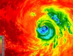
As Hurricane Matthew developed into a Category 4 hurricane that pummeled the Caribbean and southeastern United States, killing more than 1,000 people, disrupting electricity and other utilities to hundreds of thousands, and causing billions of dollars in economic damage, many of the world’s satellites and sensors were tuned to the storm, and recorded its path

Thursday, September 15th, 2016
Washington, DC — At seven feet tall and featuring 55-inch screens, the 30 kiosks coming to downtown D.C. will be much more than glorified digital ad machines. Designed by New York–based Smart City Media, the kiosks will feature timely information relating to nearby restaurants, retail, events, and public transportation. This pilot program is led by