Tuesday, February 5th, 2013
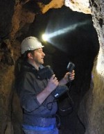
3D Laser Mapping has announced the latest in a series of free, application specific workshops designed to promote a new range of innovative, hand-held 3D laser scanners. Aimed at potential users of the Mantis Vision imager from within the Archaeological and Heritage sectors, the workshop will take place on the 14 March, 2013 at the
Tuesday, July 17th, 2012
Advanced mine monitoring system is helping geotechnical engineers predict potentially dangerous pit movements at the largest goldmine in Latin America. Installed at Newmont Mining Corporation’s Minera Yanacocha gold mine in northern Peru, 3D Laser Mapping’s SiteMonitor system continuously monitors one of the six active pits. Using state of the art laser scanners the system can