Monday, February 15th, 2016
The use of unmanned aerial vehicles — drones — to document and monitor a ravaged landscape on the Dead Sea Plain in Jordan for the past three years reveals that looting continues at the site, though at a measurably reduced pace, according to a DePaul University archaeologist. “Drones are proving to be powerful new tools
Thursday, August 14th, 2014
Archaeologists around the world, who have long relied on the classic tools of their profession, like the trowel and the plumb bob, are now turning to the modern technology of drones to defend and explore endangered sites. And perhaps nowhere is the shift happening as swiftly as in Peru, where Dr. Castillo has created a
Wednesday, August 13th, 2014
A team from the University of Leicester is about to investigate the potential for drones in the advancement of our understanding of heritage landscapes. Using novel Ground Penetrating Radar (GPR) techniques from the platform of a UAV, researchers hope to investigate previously inaccessible sites in a bid to better understand them and to explore the
Tuesday, February 5th, 2013
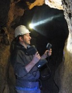
3D Laser Mapping has announced the latest in a series of free, application specific workshops designed to promote a new range of innovative, hand-held 3D laser scanners. Aimed at potential users of the Mantis Vision imager from within the Archaeological and Heritage sectors, the workshop will take place on the 14 March, 2013 at the
Friday, September 21st, 2012
On 20 September 2012, MOLA (Museum of London Archaeology) and FIND launch a new online heritage assessment service for Great Britain, available at HeritageRisk.co.uk. The online and tablet friendly service, offers planners, developers and surveyors the opportunity to order bespoke heritage and archaeology risk assessment reports, simply by selecting the area of a site on
Wednesday, August 8th, 2012
Aurora Flight Sciences’ Skate Small Unmanned Aerial System (SUAS) recently traveled to Peru in support of Vanderbilt University’s efforts at the Mawchu Llacta archeological site. Aerial survey operations using Skate(R) consisted of routine survey flights at altitudes above 13,000 ft. MSL using a High Definition (HD) camera to capture still images.
Thursday, May 31st, 2012
Some of us never outgrow that desire to seek out and explore ancient ruins. And, as it turns out, much of the ancient world remains unexplored and undiscovered. I am a “space archaeologist,” a new subfield of archaeology where satellite imagery is used to map and locate ancient archaeological sites and features across the globe.