Thursday, April 13th, 2017
The UK’s National Trust has turned to aerial laser mapping to create accurate 3D models of the Dudmaston Hall estate in Shropshire. Working with aerial mapping company Bluesky, the Trust plans to improve access to the historically and culturally important estate. Measurements captured using aircraft mounted lasers have been used to create the 3D visualisations
Thursday, January 5th, 2017
El Segundo, CA – Maproom, a powerful plug-in invented by Netherlands-based software developer Klaas Nienhuis, now enables users to create streamlined 3D city models quickly and easily in Autodesk’s 3ds Max®. Nienhuis developed Maproom to make it fast, easy, and straightforward to build a real city in just minutes. Maproom teamed with Southern California-based CyberCity
Monday, June 13th, 2016
Anaheim, California, June 13th, 2016 – Technological leaders, PDF3D, have today announced a new development in GIS processing that gives users of Hexagon’s ERDAS IMAGINE software a powerful feature designed to integrate 3D PDF reporting by way of a simple plugin. Visual Technology Services, the developers behind the PDF3D Spatial Modeler plugin, have officially released
Friday, September 18th, 2015
Intergeo, Stuttgart, September 18, 2015 —Swedish 3D industry repeatedly has innovated in public use of 3D and in particular in external city planning applications and has received several international awards. Now again Swedish cities are involved in projects reinventing the use of 3D city models in promotion of the city and in public participation.
Friday, September 18th, 2015
September 18, 2015 — We live in a 3D world and like to explore it in 3D too. With Esri ArcGIS, your organization has the ability to visualize and analyze 3D geographic information and share that information with others who want to understand change and plans in a real-world context.
Wednesday, June 3rd, 2015
LAS VEGAS, USA/HEERBRUGG, SWITZERLAND, June 3 2015 — Leica Geosystems released the revolutionary touch-technology software Leica Captivate today within the world’s first self-learning MultiStation and total stations.

Tuesday, February 5th, 2013
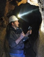
3D Laser Mapping has announced the latest in a series of free, application specific workshops designed to promote a new range of innovative, hand-held 3D laser scanners. Aimed at potential users of the Mantis Vision imager from within the Archaeological and Heritage sectors, the workshop will take place on the 14 March, 2013 at the
Wednesday, January 30th, 2013
Intermap (TSX: IMP), (OTCBB: ITMSF), a leading provider of geospatial solutions on-demand created from its uniform, high-resolution 3D digital models of the earth’s surface, today announced that the Company has completed the final contracting requirements relating to the US $14.5 million Letter of Award previously announced on January 15, 2013. Under the terms of the contract, Intermap will
Tuesday, January 29th, 2013
Intergraph announces the release of LPS 2013 as part of Intergraph Geospatial Portfolio 2013. A powerful photogrammetry system available in a user-friendly environment that guarantees results even for photogrammetry novices, LPS 2013 provides enhanced tools for delivering full analytical triangulation, digital terrain model generation, orthophoto production, mosaicking, and 3D feature extraction. LPS 2013 increases organizational
Tuesday, July 17th, 2012
Advanced mine monitoring system is helping geotechnical engineers predict potentially dangerous pit movements at the largest goldmine in Latin America. Installed at Newmont Mining Corporation’s Minera Yanacocha gold mine in northern Peru, 3D Laser Mapping’s SiteMonitor system continuously monitors one of the six active pits. Using state of the art laser scanners the system can