The first global map of vegetation from the recently launched Proba-V has been unveiled, demonstrating that the minisatellite is on track to continue a 15-year legacy of global vegetation monitoring from space. Proba-V is designed to map land cover and vegetation growth across the entire planet every two days. The data can also be used for day-by-day tracking of extreme weather, alerting authorities to crop failures, monitoring inland water resources and tracing the steady spread of deserts and deforestation.
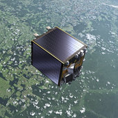 Slightly larger than a washing machine, the miniature satellite was launched from French Guiana in the early hours of 7 May. Just over a week later, its Vegetation imager was switched on in time to capture its first image over France’s west coast along the Bay of Biscay.
While still being commissioned, the satellite continued to acquire images that have been stitched together to give us the mission’s first, uncalibrated map of global vegetation – unveiled last week at the Probing Vegetation conference in Antwerp, Belgium.
“The results of these weeks of Proba-V commissioning give us confidence that the Vegetation users will not be disappointed and will benefit from the new higher performance Proba-V products,” noted Alberto Tobias, Head of ESA’s Systems, Software and Technology Department.
The commissioning phase includes a careful cross-calibration of the Vegetation imager with the previous generation of the instrument, operating on France’s Spot-5 satellite, to ensure data compatibility.
The Spot-Vegetation mission, flown aboard both the Spot-4 and Spot-5 satellites, marked 15 years of service in May, but will come to an end after Proba-V takes over later this year. Achievements of the Vegetation imaging instruments were also highlighted at the conference.
Proba-V will also bridge the gap in vegetation monitoring between Spot-Vegetation and the future Sentinel-3 mission, being developed for Europe’s Global Monitoring for Environment and Security programme.
