NV5, a US-based provider of compliance, technology, and engineering consulting solutions, has added the Leica TerrainMapper-3 to its airborne fleet following an extensive real-world evaluation programme across complex landscapes.
Proven performance for all terrain
Survey teams mapping steep mountainous landscapes, corridors, or dense urban infrastructure face significant challenges, often having to choose between flying multiple passes to capture adequate point density or accepting gaps in coverage that can create delays in the office. A configurable LiDAR architecture, like that found in the Leica TerrainMapper-3, allows them to tailor the scan pattern to the terrain before taking flight, optimising data capture through circular, elliptical, and skew ellipse modes.
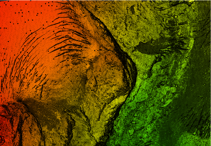
Mount Rainier mapped with Leica TerrainMapper-3
NV5’s evaluation program put this flexibility to the test, validating the Leica TerrainMapper-3 across a wide range of real production environments and terrain types, assessing not only data quality but also reliability, ease of integration, processing throughput, and overall acquisition efficiency.
One of the most demanding projects within the evaluation programme was mapping the Mount Rainier area in Washington State, an environment characterised by steep terrain, glaciers, and more than 4,000 metres of elevation change from valley to summit. There, NV5 evaluated the TerrainMapper-3’s configurable scan patterns, validating the system’s ability to maintain point density and coverage across large elevation changes, while minimising obstructions and reducing the need for additional flights. The project also demonstrated how efficient acquisition directly impacts downstream production, supporting high-quality deliverables for hazard modelling, emergency planning, and public safety applications.
“Consistent results require excellence in acquisition, processing and manufacturer support” said Jon Wittman, VP of Data Acquisition at NV5. “TerrainMapper-3 provides a complete and efficient solution that adapts to diverse mission needs while delivering consistent results, giving us the confidence to execute complex projects at scale, backed by Leica Geosystems’ global service and support network.”
NV5’s adoption of Leica Geosystems airborne solutions within its fleet, including the Leica CoastalMapper, Leica Chiroptera-5 and Leica HawkEye-5, reinforces its commitment to delivering high-precision geospatial intelligence across complex environments.
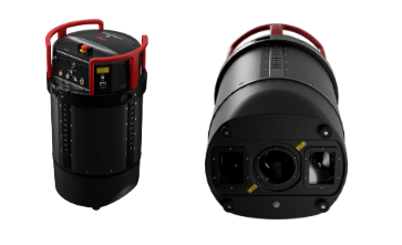
Leica TerrainMapper-3 features a LiDAR sensor with a field of view of up to 60° and three configurable scan patterns. The system is further enhanced by the Leica MFC250 camera system.
Hybrid sensors and scalable workflow
Key differentiators influencing NV5’s decision to purchase the system include the integrated Sony IMX811-based MFC250 imaging module, providing high-resolution imagery across the full LiDAR swath, and Leica Geosystems’ unified end-to-end workflow supporting hybrid sensor data from acquisition through quality review and processing for efficient and scalable data production.
“The TerrainMapper-3 reflects our focus on building solutions that meet our customer needs, combining flexibility, precision, and efficiency at scale,” said Steve Cooper, ABS Global Sales Director at Leica Geosystems, part of Hexagon. “We value our long-standing partnership with NV5, and we are proud to support their team with a technology they can trust and global reach to accelerate their growth.”
Find out more about the Leica TerrainMapper-3 here
