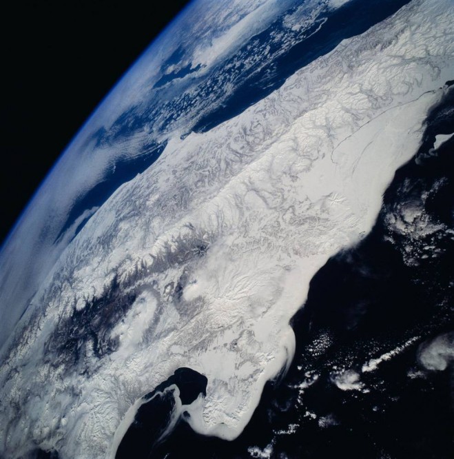

View southwestward across the Kamchatka Peninsula. The cluster of volcanoes in the middle distance are active, including Klutchevskaya, whose summit reaches 15,580 feet. (Credit: NASA)
Snowflakes that cover mountains or linger under tree canopies are a vital freshwater resource for over a billion people around the world. To help determine how much freshwater is stored in snow, a team of NASA-funded researchers is creating a computer-based tool that simulates the best way to detect snow and measure its water content from space.
Snow’s water content, or snow water equivalent (SWE), is a “holy grail for many hydrologists,” said Bart Forman, the project’s principal investigator and a professor with the University of Maryland, College Park. When snow melts, the ensuing puddle of water is its SWE.
In western U.S. states, snow is the main source of drinking water, and water from snow is a major contributor to hydroelectric power generation and agriculture.
Some changes in snowfall patterns are indicators of climate change. For instance, warmer temperatures cause water to fall as rain instead of snow. As a result, some mountains are not able to hold water in the form of snowpack like they used to, which means rain inundates rivers, and floods are more intense. When flood season is over, droughts can be more severe.
Forman’s new approach follows efforts by NASA to study SWE from satellites, airplanes and the field. The Moderate-resolution Imaging Spectroradiometer(MODIS) is an instrument aboard two satellites that captures daily images of Earth. MODIS can identify snow-covered land and ice on lakes and large rivers. The Global Precipitation Measurement mission (GPM), an international constellation of satellites, can observe rain and falling snow over the entire globe every two to three hours.
In addition to space-based observations, NASA runs a campaign closer to home called SnowEX. The campaign is a five-year program that includes airborne observations and then field work to reveal what satellite efforts do not. SnowEX allows researchers to examine complex terrains that can be difficult to characterize from space. Next winter’s campaign will collaborate with the Airborne Snow Observatory, which measures snow depth and snow characteristics.


