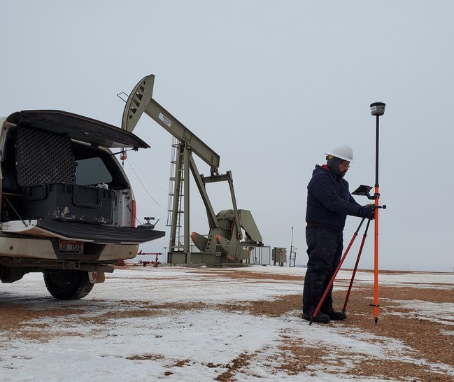
DENVER – Operators of underground oil and gas flowlines in Colorado can comply with newly revised state regulations requiring accurate, universal flowline location data with a field service from EcoPoint Inc., a Colorado-based firm specializing in geospatial data solutions.

Published by the Colorado Oil and Gas Conservation Commission on Jan. 14, the new regulations require operators to provide GIS mapping data of the full length of both operating and abandoned underground flowlines before the end of this year. The requirements expand on regulations that required location data for flowline start and end points, and were due Oct. 31, 2019.
“Oil and gas producers can quickly realize operational and asset management benefits with geospatial data management,” said EcoPoint CEO Michael Clancy. Flowline GIS data is easily integrated into an existing database or it can provide the foundation for a valuable, active information system built for growth and accessibility.
“Whether it’s a few feet or several miles, having precise location information can greatly reduce the time spent responding to the next line locate request,” Clancy said. “Our clients report saving up to 70 percent on subsequent line locates.”
EcoPoint’s flowline mapping service produces data sets in standard GIS formats and includes completion of COGCC’s flowline compliance Form 44. A mapping database can then expand the operator’s asset management knowledge base with a system that is scalable and accessible anywhere on any device.
“Our flowline service is more than just regulatory compliance. It creates a live, interactive geospatial database for the long term that improves efficiency and provides real value to the company,” Clancy said.
Revision of the COGCC’s Reg. 1101-b-3-C followed passage of legislation known as SB 19-181 last year. It states operators must submit the most accurate GIS data possible for the full length of all off-location flowlines without using invasive methods.
EcoPoint’s flowline service includes flowline data modeling and configuration, onsite line locates, GIS data capture, forms completions and consultations.
About EcoPoint Inc.
Founded in 2018, EcoPoint Inc., of Rifle, CO, is an ecological services and Esri partner company providing GIS database solutions for large-scale monitoring efforts. Its clients include public and private land users in agriculture, energy, mining and right of way.
Information about EcoPoint Inc. is available at: https://ecopoint-inc.com, email: [email protected] or call: 844-832-3547