Sydney, Australia – BigData Earth has just released a new web App on location-centric exposure management specific to emergency and insurance applications.
The new App combines web mapping, analysis and reporting together, and takes advantage of the cloud-based big data and analytics platforms and foundational Location Profile APIs (on property location and hazard risk information) the company has built over the past few years. The geographic coverage of the new App includes Australia and the Contiguous US.
The App contains two levels of exposure analyses:
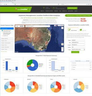
Figure 1
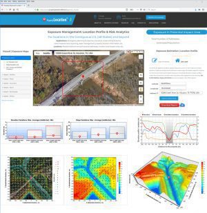
Figure 2:
The new web App has been hosted by two big data and analytics platforms:
Customization and enhancement of the App is ongoing in response to different geographic coverage, new datasets, client’s requirements and tailored analyses.
BigData Earth ( http://www.bigdataearth.com/) is a data science/technology R&D company creating innovative Location-centric Business Applications worldwide using Geospatial Big Data Analytics, Global Earth Observation and Cloud Computing
