Monday, November 14th, 2016
STILLWATER, OK – AgPixel® is offering agronomists the ability to seamlessly integrate high-resolution imagery via the agX Platform®. “AgPixel is excited to release high-resolution imagery through the agX Store,” said Kirk Demuth, Chief Operating Officer for AgPixel. “We understand the pressure agronomists are under to increase yields and reduce inputs. Delivering imagery through agX will

Monday, November 14th, 2016
WESTMINSTER, Colo. — DigitalGlobe, Inc. (NYSE: DGI), the global leader in earth imagery and information about our changing planet, today announced the successful launch of WorldView-4, the company’s newest high-accuracy, high-resolution commercial imaging satellite. DigitalGlobe acquired signals from the satellite indicating its proper position and health 45 minutes after its launch aboard an Atlas V

Monday, November 14th, 2016
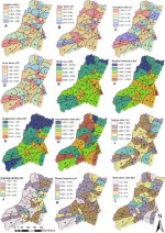
Researchers from UT Dallas and other universities developed geospatial science methods to help the Egyptian government determine how to avoid flooding in a coastal mountain region. The government wants to develop the area for tourism, but flash flooding and associated hazards have hampered efforts, according to Dr. May Yuan, Ashbel Smith professor of GIS. “We
Friday, November 11th, 2016
LAS VEGAS – Trimble (NASDAQ: TRMB) announced today new data processing capabilities for Trimble Connect™ software, a cloud-based collaboration ecosystem. The automated solution uses the scalable processing power of the cloud to significantly reduce time to delivery of actionable information. The automation platform takes advantages of accelerated upload technology and scalable cloud computing to deliver
Friday, November 11th, 2016
Orlando, FL – AU Las Vegas 2016 will be held at the Venetian in Las Vegas, Nevada from November 15-17, 2016. Please join the RIEGL experts at Booth 2926 to learn about the RIEGL product portfolio for terrestrial, mobile, airborne, and unmanned based laser scanning. Come by to learn about how our hardware and software
Friday, November 11th, 2016
Redlands, California—Esri, the global leader in smart mapping, has published Map Use: Reading, Analysis, Interpretation, eighth edition. Esri president Jack Dangermond called the 650-page textbook “a comprehensive primer for using maps effectively.” Map Use teaches map fundamentals—what maps are; the types available; what they portray; the purposes they serve; and how to read, analyze, and
Friday, November 11th, 2016
Asteri Navigation will introduce a new line of rugged, compact and fully integrated GNSS receivers on November 15 at the 2016 Autodesk University in Las Vegas. Designed for geospatial field data collection and inspection applications that require high accuracy positioning, the Asteri X-Series receivers are light enough to be mounted to external sensors or worn
Friday, November 11th, 2016
Aerial mapping company Bluesky has used aircraft mounted lasers to create 3D maps of potentially important archaeological sites in Devon, England. Funded by Historic England (formerly English Heritage), the LiDAR surveys were commissioned by Devon County Council’s Historic Environment team with support from the Blackdown Hills Area of Outstanding Natural Beauty (AONB) and The East
Friday, November 11th, 2016
VIENNA, Va. – AT&T* and the National Aeronautics and Space Administration (NASA) are researching traffic management solutions for Unmanned Aircraft Systems (UAS). The goal is an Unmanned Aircraft System Traffic Management (UTM) solution that supports the safe and highly secure operation of drones in the national airspace. AT&T has been working with NASA and other companies
Friday, November 11th, 2016
San Francisco/Zurich – CloudCities will provide the interactive 3D conference map for Autodesk University (AU) 2016, which will be displayed on multiple large screens at the venue. The 3D map hosted on CloudCities gives an overview of the events and exhibits – both outdoors on the Las Vegas strip and indoors within the Venetian hotel.