Wednesday, March 29th, 2017
FORT COLLINS, Colorado – Remote GeoSystems, Inc. is pleased to announce the release and availability of the all new LineVision™ Google Earth Extension – commercial software for UAV, airborne & terrestrial mobile inspection and survey projects requiring georeferenced video playback, analysis, collaboration and reporting using Google Earth & other GIS applications. Unlike its stand-alone predecessor,
Tuesday, March 28th, 2017
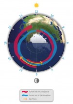
Information from the European Space Agency (ESA) magnetic field Swarm mission led to the discovery of supersonic plasma jets high up in Earth’s atmosphere that can push temperatures up to almost 10,000 degrees Celsius. Presenting these findings at the Swarm Science Meeting in Canada, scientists from the University of Calgary explained how they used measurements
Tuesday, March 28th, 2017
CARMEL, Indiana – PrecisionPoint Inc., a national provider of 3D reality capture laser scanning and SCAN-to-BIM Modeling solutions, is pleased to announce the hiring of Will Hirschfeld, an experienced Unmanned Aerial System (sUAS) pilot. Hirschfeld will assist PrecisionPoint as it enhances existing 3D documentation capabilities and expands into new services areas using sUAS technology, including
Tuesday, March 28th, 2017
Aerial mapping company Bluesky has launched a new online Mapshop to serve the rapidly expanding mapping and geographic information industry in Ireland. With tens of thousands of square kilometres of new data available to view and download, this is the largest and most up to date collection of geographic information focused on a market with
Tuesday, March 28th, 2017
Portland, Maine, USA – Commercial UAV Expo today announced the release of a free series of reports that showcase how and where professionals charged with the inspection and monitoring of industrial assets such as electricity pylons, pipelines, and rails are actually using drones to make these tasks more efficient and safer. Additionally, the reports focus on
Monday, March 27th, 2017
GPSengine a leading hosted platform service provider in GNSS, Telematics, IoT and Tracking announced today that Jointech is an official Platform Connect partner. With support built into Platform Connect for Jointech’s tracking devices, customers have the opportunity to take advantage of these combined offerings to meet their fleet tracking solution needs. With a focus on
Monday, March 27th, 2017
The Open Geospatial Consortium (OGC®) is requesting public comment on the proposed Indexed 3D Scene Layers Community Standard. Indexed 3D Scene Layers (I3S) was submitted by Esri for consideration as an OGC Community Standard. The submission was supported by 13 OGC member organizations. A single I3S data set, referred to as a Scene Layer, is
Monday, March 27th, 2017
TCarta Marine, a global provider of marine geospatial products, has announced the launch of Bathymetrics, an online portal offering instant access to satellite-derived bathymetric data sets. TCarta Marine will unveil the Bathymetrics portal and initial 2-metre data sets at the upcoming Ocean Business 17 Conference in Southampton, England. “The Bathymetrics portal will enable customers to
Monday, March 27th, 2017
MCLEAN, Va. — From navigating a U.S. aircraft to making national policy decisions, to responding to natural disasters: today’s U.S. armed forces rely on Geospatial Intelligence (GEOINT) to meet mission requirements. As the nation’s primary source of GEOINT for the Department of Defense and the U.S. Intelligence Community, the National Geospatial-Intelligence Agency (NGA) depends on
Monday, March 27th, 2017
SAN DIEGO – General Atomics Aeronautical Systems, Inc. (GA‑ASI), a leading manufacturer of Remotely Piloted Aircraft (RPA) systems, radars, and electro-optic and related mission systems solutions, today announced that the Defense Advanced Research Projects Agency (DARPA) has continued to contract the company for Phase 2 of the Gremlins program. The Gremlins program seeks to develop
